DESERTS AND WINDS 19
INTRODUCTION
Deserts and Winds
CHAPTER OUTLINE
1.
308

2.
3.
4.
309

5.
6.
310

LEARNING OBJECTIVES/FOCUS ON CONCEPTS
19.1 Describe explain
19.3 Discuss
19.5 Describe
311

TEACHING STRATEGIES
Clicker Questions:
Practice Questions: Glaciers and Glaciation
Muddiest Point:
Where Deserts Occur.
o
Features of Deserts.
312

TEACHER RESOURCES
Web Resources:
NASA Earth Observatory
Places with deserts and desert features:
Imagery, Animations, and Videos:
Images
313

Animations
Video
ANSWERS TO QUESTIONS IN THE CHAPTER:
CONCEPT CHECKS
19.1 DISTRIBUTIONS AND CAUSES OF DRY LANDS
1. The boundary between humid and dry climates cannot be defined by a single rainfall amount
2. Desert and steppe regions on Earth cover about 42 million square kilometers, or about 30
percent of Earths land surface.
3. Subtropical deserts and steppes form due to the global distribution of air pressure and winds.
4. Some subtropical deserts occur along coastlines and are much colder than other subtropical
5. Middle-latitude dry regions exist where interiors of landmasses are sheltered and isolated from
19.2 GEOLOGIC PROCESSES IN ARID CLIMATES
1. Humid climates have strong chemical weathering. In dry lands, rock weathering of any type is
2. An ephemeral stream is a stream that carries water only in response to specific rainfall events.

3. When a permanent stream crosses a desert, the rivers discharge decreases as water is lost due
19.3 BASIN AND RANGE: THE EVOLUTION OF A DESERT LANDSCAPE
2. First, uplift produces mountains and running water begins to carve the elevated mass and
deposits large amounts of sediment in the basins. Relief is greatest in this stage. Next,
3. The Basin and Rang region of the western United States displays all stages of desert landscape
19.4 TRANSPORTATION OF SEDIMENT BY WIND
1. Wind is turbulent and can pick up loose sediment and transport it to other locations. Wind
19.5 WIND EROSION
1. Wind erosion is more effective in arid lands, rather than humid areas, because in humid places
3. One model of the formation of desert pavement is characterized by the removal of fine particles
4. Ventifacts are faceted stones created when prevailing winds abrade and polish the sides of stones
19.6 WIND DEPOSITS
1. Sand dunes migrate as sand grains move along the dune in the wind. Sand grains move up the
2. The basic dune types are:
a. Barchan dunessolitary sand dunes shaped like crescents and with their tips pointing
downwind.
315

3. Loess is deposits of windblown silt deposited by dust storms near desert regions, or by strong
4. Some loess deposits are indirect products of glaciation. Their source is stratified drift; strong
westerly winds during the ice age swept across outwash plains, picked up finer sediment, and
deposited as blankets on the eastern side of valleys.
EYE ON EARTH
EOE #1 APOLLO 8 EARTH VIEW
2. The ocean current that flows along this coast is cold; it must flow toward the equator,
bringing colder water from the poles to the tropics and equator.
4. Deserts such as the Sahara and Arabian are formed due to sinking air along 30 degree
latitudes. In these areas, dry air sinks, compresses, and warms, and gives very little
EOE #2 ZAGROS MOUNTAINS, IRAN
1. This large feature is an alluvial fan.
2. This alluvial fan develops during wet events where sediment-laden water leaves the
4. The likely source of water in the green agricultural areas of this image is water that
EOE #3 WINDBLOWN SEDIMENT PLUME
1. This wind-blown sediment is a plume of dust.
3. Sandstorm is not an appropriate term for this event because the grain sizes carried in this
plume are likely much smaller than sand grains.
EOE #4 PRESTON MESA DUNES, ARIZONA
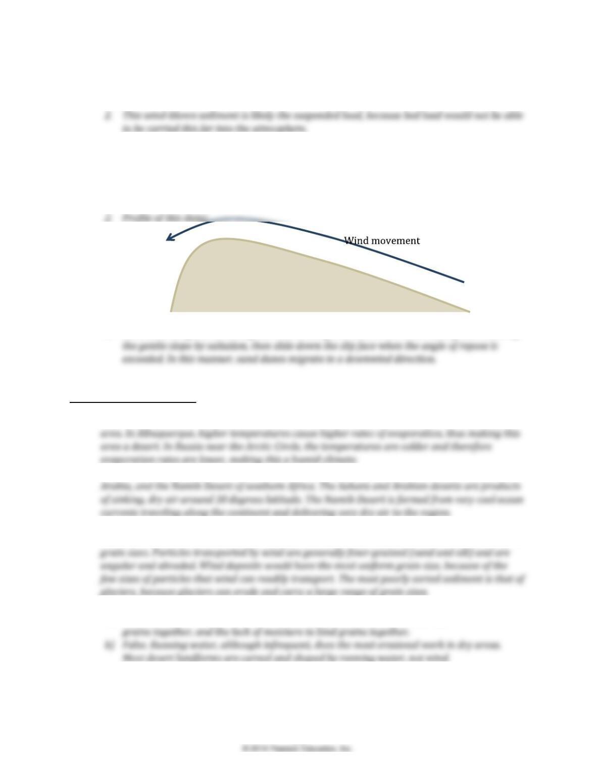
1. This dune type is a barchan, or possibly barchanoid, dune.
3. Sand dunes migrate as sand grains move along the dune in the wind. Sand grains move up
GIVE IT SOME THOUGHT
1. Annual precipitation, along with rates of evaporation, are used to determine the dryness of an
2. In this view of Earth, we see the Sahara Desert of northern Africa, the Arabian Desert of Saudi
3. Sediments deposited by a stream are usually well-sorted and rounded; sorting is a function of
stream velocity. Sediment transported by glaciers are poorly sorted and show a large variety of
4.
a) True. Wind is more effective at erosion in dry areas due to the lack of vegetation to hold
5. Sand does not travel more than 1 meter into the air, so could not have been responsible for
creating these very tall features. These hoodoos are created from limestone, a rock that is fairly
317

6. The dunes in the lower right of Figure 19.21 appear to be barchan to barchanoid in shape.
7. This side of the dune is called the slip-face. The prevailing wind direction is coming out of the
photo, towards the viewer, because this image represents material spilling down the steep side
318