GLACIERS AND GLACIATION 18
INTRODUCTION
Glaciers and Glaciation
CHAPTER OUTLINE
1.
289
2.
290
3.
4.
292
5.
293
6.
moraine
7.
294
8.
295
9.
10.
296
LEARNING OBJECTIVES/FOCUS ON CONCEPTS
18.2 Describe
18.4 Identify and describe
18.6 List and describe
18.8 Describe and explain
297
18.10 Summarize
TEACHING STRATEGIES
Clicker Questions:
Muddiest Point:
298
TEACHER RESOURCES
Web Resources:
299
Alpine Glaciers
Antarctica
Artic
Glacial Lakes
Ice Ages
300
Places With Glaciers and Glacial Features
Imagery, Animations, and Videos:
Images
Animations
301
Video
ANSWERS TO QUESTIONS IN THE CHAPTER:
CONCEPT CHECKS
18.1 GLACIERS: A PART OF TWO BASIC CYCLES
2. Precipitation that falls at high elevations or high latitudes is often stored in glacial ice for
3. Valley, or alpine, glaciers are relatively small glaciers that follow former stream valleys in
mountainous regions. Ice sheets are glaciers that cover large regions and consist of masses of
4. Ice shelves represent the portions of ice sheets that flow out over the ocean. Ice shelves are
18.2 FORMATION AND MOVEMENT OF GLACIAL ICE
1. When temperatures remain below freezing after a snowfall, snow crystals become smaller,
thicker, and more spherical as their extremities evaporate and water vapor condenses near
2. Glaciers flow by plastic flow within the ice; plastic flow is a result of stress on the ice and
causes layers of molecules of glacial ice to slide over one another. Basal slip occurs at the base
302
3. The velocity of glacial ice varies considerably from one glacier to another. Satellite imaging of
4. The two zones of a glacier are the zone of accumulation and the zone of wastage. The zone of
5. When accumulation exceeds wastage, the glacier advances. When wastage exceeds
18.3 GLACIAL EROSION
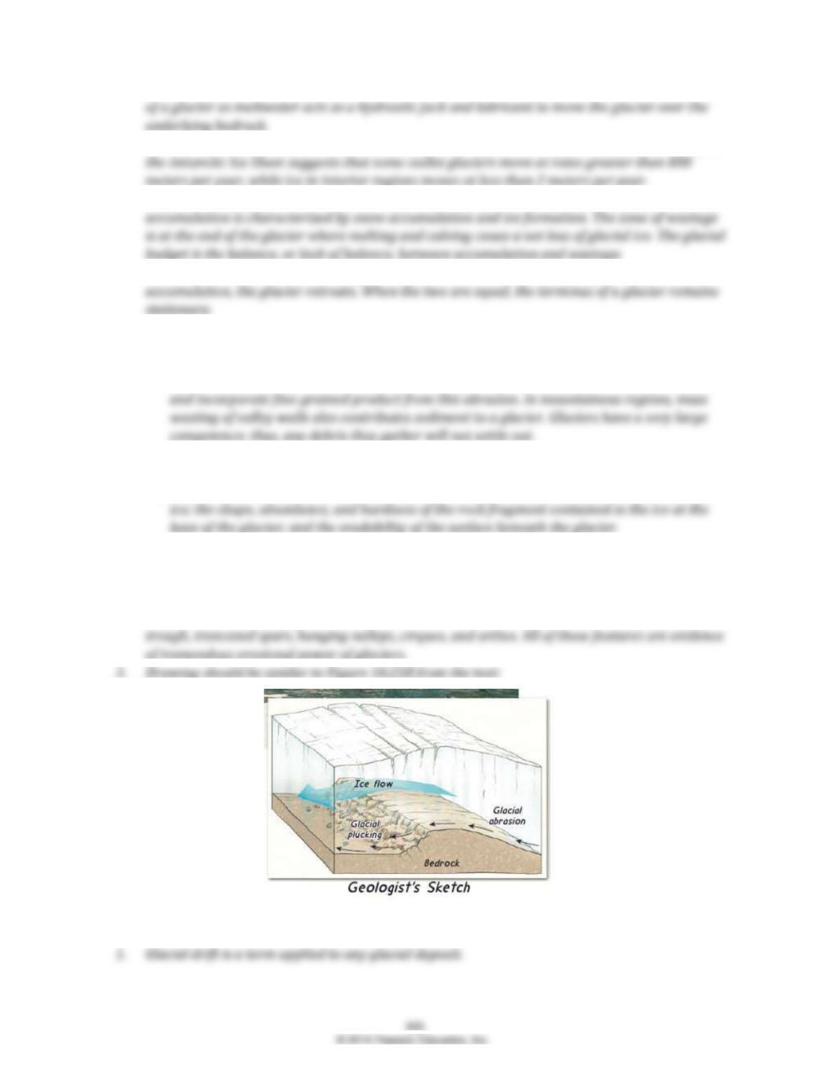
1. Glaciers accumulate sediment by plucking and abrasion. Plucking is the loosening and lifting
of blocks of rocks. Abrasion is similar to sandpaperglaciers abrade the bedrock surface
2. Visible effects of glacial erosion include glacial striations, glacially polished rocks, the presence
of glacial erratics, and the sediment deposited at a glaciers terminus.
3. A glaciers capacity to erode is controlled by: the rate of glacial movement; the thickness of the
18.4 LANDFORMS CREATED BY GLACIAL EROSION
1. A mountain valley that was not glaciated typically has narrow V-shaped stream valleys.
Glaciated valleys are wider, deeper, and U-shaped, and have sharp, accentuated features.
2. In an area where valley glaciers recently existed, we would expect to see a U-shaped glacial
18.5 GLACIAL DEPOSITS
3. A glacial erratic is a large rock or boulder on the landscape with a composition markedly
18.6 LANDFORMS MADE OF TILL
1. Medial and lateral moraines both occur in mountain valleys and represent accumulations of
2. An end moraine is a ridge of till that forms at the terminus of a glacier. Ground moraine is a
gently rolling layer of till deposited along the landscape as a glacier retreats.
3. A terminal end moraine represents the furthest extent of a glacier. Recessional end moraines
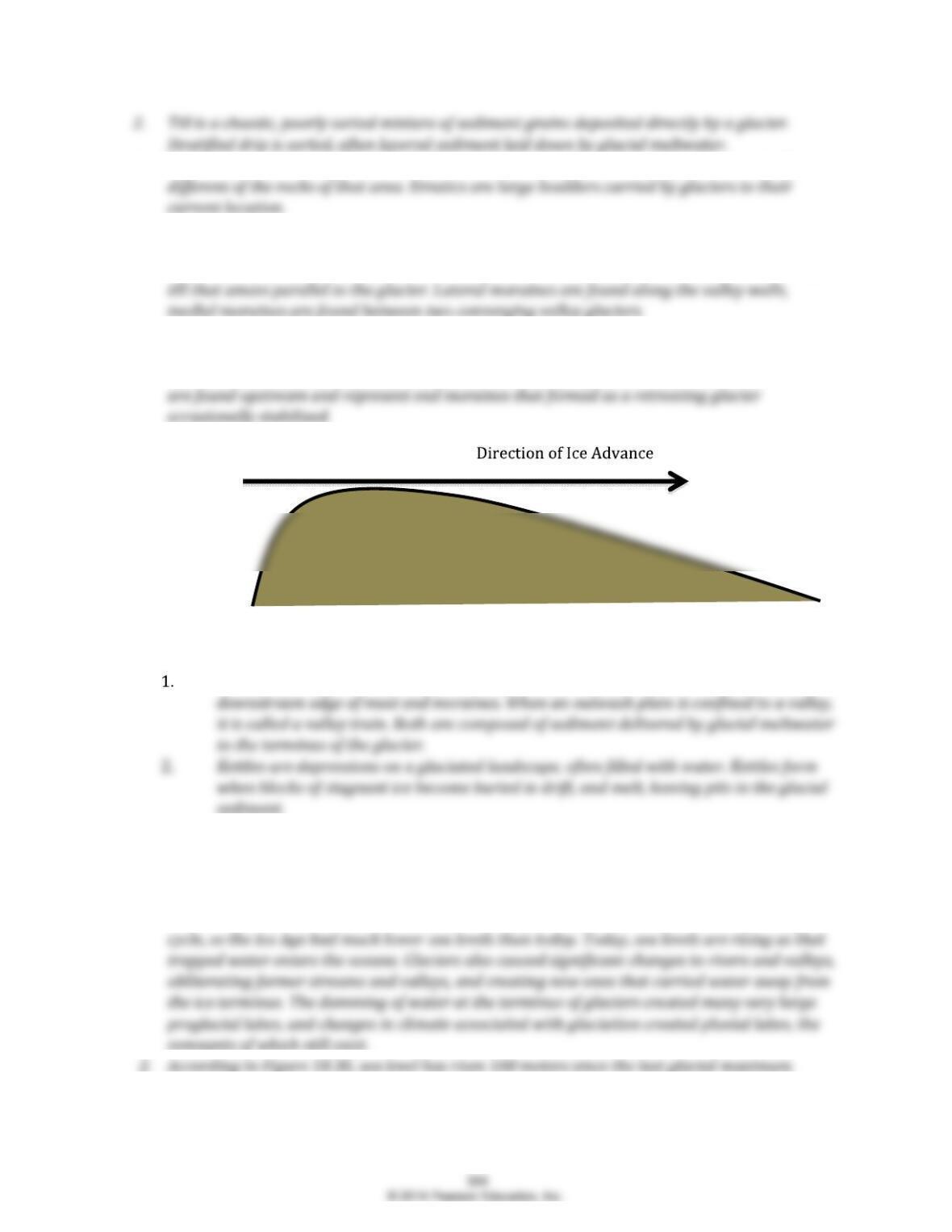
4. A side view of a drumlin:
18.7 LANDFORMS MADE OF STRATIFIED DRIFT
Outwash plains are broad, ramp-like surfaces of stratified drift built adjacent to the
18.8 OTHER EFFECTS OF ICE AGE GLACIERS
1. Ice age glaciers had many effects beyond erosional and depositional features. These masses of
ice downwarped the Earths crust, and rebounding now occurs in many areas that were once
covered by continental ice sheets. Glaciers trap large amounts of water from the hydrologic
3. From Figure 18.31, we see that the Teays River was obliterated after the last glaciation. The
path of the Ohio River was lengthened into Ohio and Pennsylvania. And the Missouri River was
4. Proglacial lakes are positioned just beyond the outer limits of a glacier or ice sheet and are
formed from meltwater that is trapped between the glacier and the topography around it.
18.9 THE GLACIAL THEORY AND THE ICE AGE
2. During the Quaternary period, almost 30 percent of Earths land surface was affected by
glaciers.
3. Ice sheets were most extensive in the Northern Hemisphere during the Ice Age. The amount of
18.10 CAUSES OF ICE AGES
1. Because glaciers can form only on land, we know that landmasses must exist somewhere in the
2. Alternating glacial/interglacial cycles during the Ice Age happened too quickly to be explained
3. Variations in Earths orbit bring Earth closer and further from the Sun. These cause changes in
the amount of solar radiation received by Earth at different latitudes. Eccentricity is changes
EYE ON EARTH
EOE #1 BYRD GLACIER, ANTARCTICA
1. Byrd Glacier is flowing towards the Ross Ice Shelf, towards the bottom of this image. We
see that the ice sheet is at the top of this image, the mountains are in the center, and the
2. The Byrd Glacier represents an outlet glacier from the main ice sheet out to the floating ice
EOE #2 ICEBERGS OFF GREENLANDS COAST
1. Iceberg form through calving. Calving is the process of large masses of ice breaking off the
2. Icebergs are only slightly less dense than seawater. Therefore, icebergs float very low in
3. Icebergs are not the same as sea ice. Icebergs are pieces of ice floating in the ocean. Sea ice
4. Because icebergs have only a slightly lower density than water, they displace about as
much water as they contain. Thus, when they melt, they do not add appreciably to sea-level
EOE #3 ST. MARY LAKE GLACIER NATIONAL PARK
1. Glacial erosion broadened and deepened this valley into a U-shape. Prior to glaciation this
valley was likely narrower, and more V-shaped.
EOE #4 MENDING WALL, NEW ENGLAND
EOE #4 ALASKA RANGE
1. The numerous stripes of debris are morainesaccumulations of sediment along the
2. The glaciers appear to be shrinking because they no longer fill their valleys (see the upper
right corner of the image).
4. A surge is a period of relatively fast movement in a short period of time.
GIVE IT SOME THOUGHT
1.
a) The average yearly rate at which ice in the center of the glacier advanced was 115 meters
per year (920 meters ÷ 8 years).
306
2.
a) If the distance from the Hudson Bay to Lake Erie is 1600 kilometers (1,600,000 meters),
3.
a) These features are called crevasses.
4. The Northern Hemisphere of Earth contains much more land than the Southern Hemisphere. If
5. Mass-wasting process can also produce unsorted deposits of sediment. Glacial deposits consist
primarily of mechanically weathered rock debris that underwent very little to no chemical
6. Glaciers are part of the hydrosphere because they are composed of frozen water. They have
7. If the budget of a valley glacier were balanced for an extended time period, a large terminal
moraine would form at the terminus of the glacier. This feature is formed from glacial till as
8. Evidence that the glacier is moving is the fractured surface of the ice. These fractures form as
307