QUESTIONS 17, PART A
Trashmore is a hypothetical city of about 40,000 in the Great Lakes region of North America. The gently
rolling landscape has been glaciated and the regolith contains silty-clay till, outwash gravels, glacial lake
deposits of clay, and modern alluvium over bedrock at depths of 0 to 100 feet. The bedrock consists of
limestone and shale formations. Trashmore has a sanitary landfill that will run out of space in two years. As a
member of Trashmore’s City Council you have been asked to assist the regional planners in selecting a
suitable site for a new sanitary landfill. You consult a portion of a geologic map and cross section of the
region (Figure 17.1) and recognize three excavated sites. If one of these pits and quarries could be used, you
think you could save on excavation costs.
1. What geologic resource (rock or sediment) was extracted at each of the three sites?
2. a. Which of the three excavated sites was your first choice for the new landfill? (Consider the physical
environmental factors, described in the Introduction to this exercise, that are important in selecting sanitary
b. What physical environmental factor(s) was important in making your selection of a landfill site?
Permeability of the material below the pit.
c. Explain why the number one factor is important.
3. List the problems that are associated with each of the other two sites not selected in Question 2a.
a. Site: ______________ ; Problems:
State Aggregate; permeable gravel, proximity to ground water and surface water resources, in the flood
b. Site: __________ ; Problems: Limestone Quarry; permeable bedrock +
the same problems for the aggregate site.
4. If you were to excavate to a deeper level at the State Aggregate pit, what additional geologic material
could you obtain?
5. Sanitary landfills must be covered daily (and after they are closed) with a low permeability material to
keep out precipitation and runoff. (Otherwise, they do not meet the regulations for sanitary landfills.)
a. Which of the four (4) materials shown in the legend of Figure 17.1 might be suitable for covering the
waste daily? Why?
b. Trashmore’s regolith has been deposited on bedrock by glacial processes. Thus the unconsolidated
material at the surface might include outwash gravel, lake silt and clay, clayey till, and wind-blown silt.
What low permeability material from the region might be suitable for landfill cover?
6. Which way is the bedrock dipping at Limey’s Limestone and what is the approximate angle of dip?
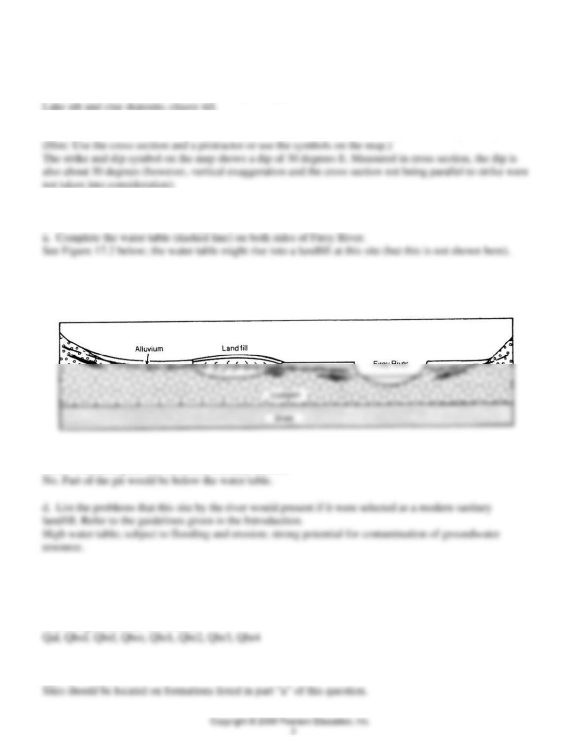
7. In Figure 17.2, a landfill is in an outwash valley on a flood plain. Many such sites were selected in
glaciated environments because a gravel pit was available.
b. Place arrows to show the flow of groundwater in your profile. (See Exercise 12 for assistance, if
needed.)
See figure below
c. Knowing that to be classified as a sanitary landfill trash cannot be dumped into standing water, would this
site be a suitable place for an unlined sanitary landfill?
QUESTIONS 17, PART B
Use information in Figure 17.3 (Waco map at back of book) and Table 17.3, to answer the following
questions.
1. a. List the geologic symbols of formations or units (Table 17.3) that might be used for extraction of
sand and gravel in the Waco area.
b. On Figure 17.3, select and mark (with “S&G”) three sites where sand and gravel that could be used as
aggregate might occur.
2. a. From what formation could you obtain ceramic grade materials?
b. On Figure 17.3, select and mark (“CM”) a potential site for extraction of high-quality (ceramic-grade)
clays.
3. a. What geologic formation would provide “dimension” building stone for Waco?
b. Why can you not mark such a site on the geologic map (Figure 17.3)?
4. From the information given in Tables 17.3, determine the geologic units that might be investigated as
potentially acceptable sites for a sanitary landfill in the West Waco area. Justify your choices by
completing the table below.
Completed table for Question 4
Geologic Unit Material Infiltration Rock and Min
Resources Groundwater
Potential
Pepper Kpe shale low possible ceramics low
South Bosque
Kbe shale low expanded aggregate none
5. In which geologic units (Table 17.3) in Waco would the greatest potential exist for contamination of
potable groundwater by leachate from sanitary landfills or abandoned dumps?
6. a. Refer to your answer to question 4 and select a possible site for a sanitary landfill. Outline this area on
the Waco West Quadrangle (Figure 17.3). Place the symbol “SL” in the center of the area. (Or describe the
location and geologic material at the site).
Students will use the information from their table to find one place where the formation selected is on the
map at a favorable location, based on the materials at the sites. The main options include:
b. State the most important factor that resulted in your decision and a possible minor problem for the site.
The most important factors in students choice will vary, but should include the infiltration, other resource
uses (geologic and groundwater potential) which seem to be a tradeoff here. Possible minor (?) problems at
each site are given below:
For the Kab site “3”, steepness of slope, and proximity to the lake.
RESOURCE-CAPABILITY MAPS AND BASIC-DATA MAPS
7. By now you probably have determined that consulting basic data tables and maps, and evaluating these
data for a specific resource use can be confusing and time consuming. Resource capability maps are often
used to ease the problem of determining the best use of the land from data in tables. Figure 17.4 is a resource
capability map showing capability for septic-tank tile fields. It has been drawn using the following basic data
or basic data maps:
Soil permeability: low permeability is a severe limitation
Depth to bedrock: less than 10 ft is a severe limitation
Slope: over 10% is a severe limitation
Flood hazard: soils with any degree of overflow present a severe limitation
Using the information in Figure 17.4, determine the potential for using septic tank systems with drain
fields in the following areas (Figure 17.3) that are being considered for subdivision development.
a. X, 1.7 miles NE of the dam of Lake Waco, on Qbr1 :
b. Y, immediately SW of Heart O’Texas Fairground, on Kau:
c. C, east of the Brazos River, on Qbr2:
Using Figure 17.4, the resource capability map for septic drain fields, site C would be in a slight
limitation area, which according to the caption is a “Capable” area.
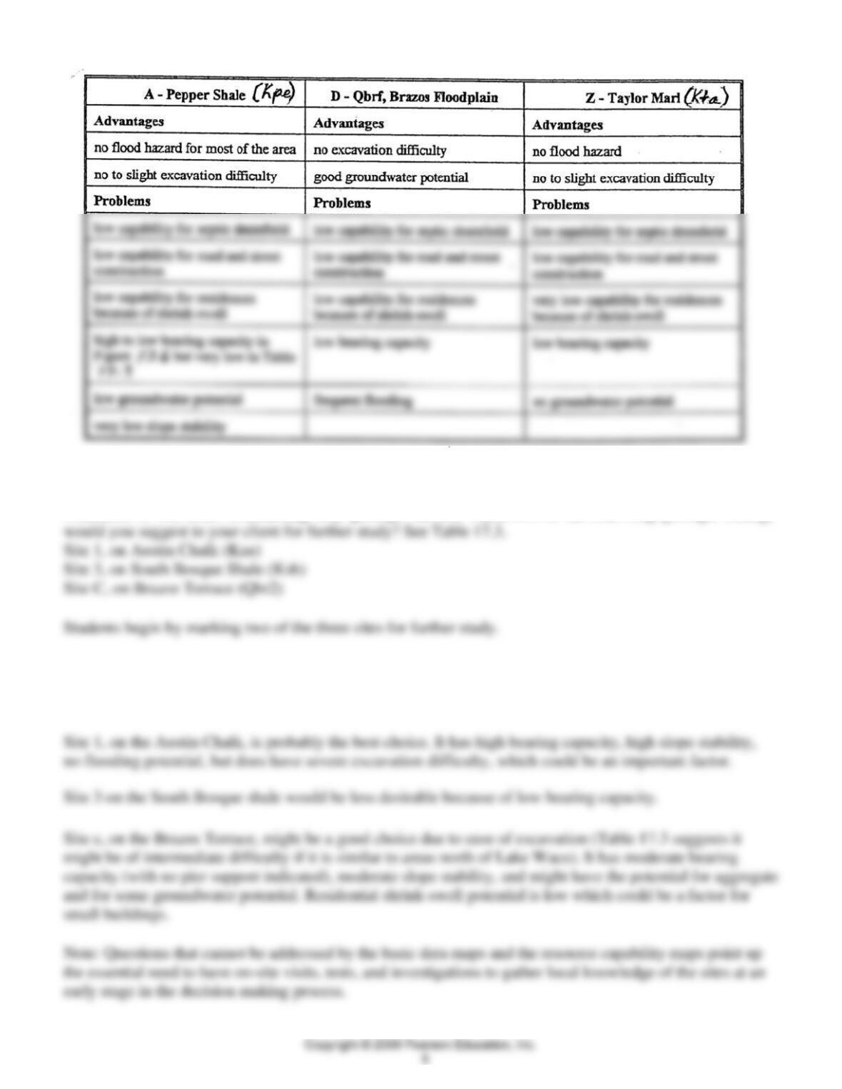
8. Using the resource capability maps (Figures 17.4, 17.5, and 17.6), basic data map (Figure 17.7), and basic
data for the geologic units in Table 17.3, evaluate one of the following areas in Figure 17.3 for possible
residential development: A, D, or Z (Kta). Describe the problems and advantages for low-density housing in
the area you select. Begin by reviewing the characteristics of each site. Then select one for your evaluation.
9. a. As an engineering geologist you are asked to assist in the selection of possible sites for construction of
a large distribution-center warehouse. It will be supported by conventional footings resting below the
weathered or soil zone. Considering only geologic factors, which two of the following geologic settings
b. Explain the reasons for your two choices, and your rejection of the third option.
Possible reasons (with potential problems) for selecting two sites for further study.