1
9.1 The function is given in the following tabulated form. Compute with and
with .
(a) Use the composite rectangle method.
(b) Use the composite trapezoidal method.
(c) Use the composite Simpson’s 3/8 method.
Solution
(a) For the composite rectangle method, Eq. (9.4) is used:
There are seven points spaced 0.2 units apart, so if , there are six intervals and . In this case,
Eq. (9.4) gives
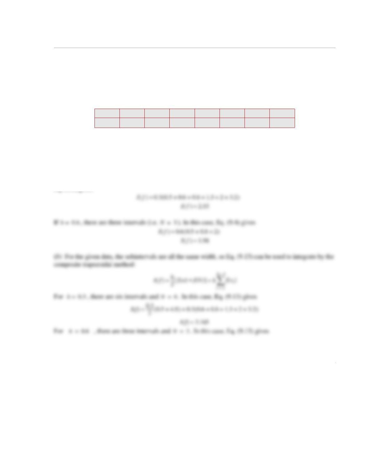
x00.3 0.6 0.9 1.2 1.5 1.8
0.5 0.6 0.8 1.3 23.2 4.8
fx()
fx()xd
0
1.8
h0.3=
h0.6=
fx()
If() fx()xd
a
b
hfx
i
()
i1=
N
≈=
h0.3=
N6=
N3=
h0.3=
2
(c) For the given data, the subintervals are all the same width, so Eq. (9.22) can be used to integrate by the
composite Simpson’s 3/8 method:
If() 0.6
2
——– 0.5 4.8+()0.6 0.8 2+()+≈
If() 3.27≈
1
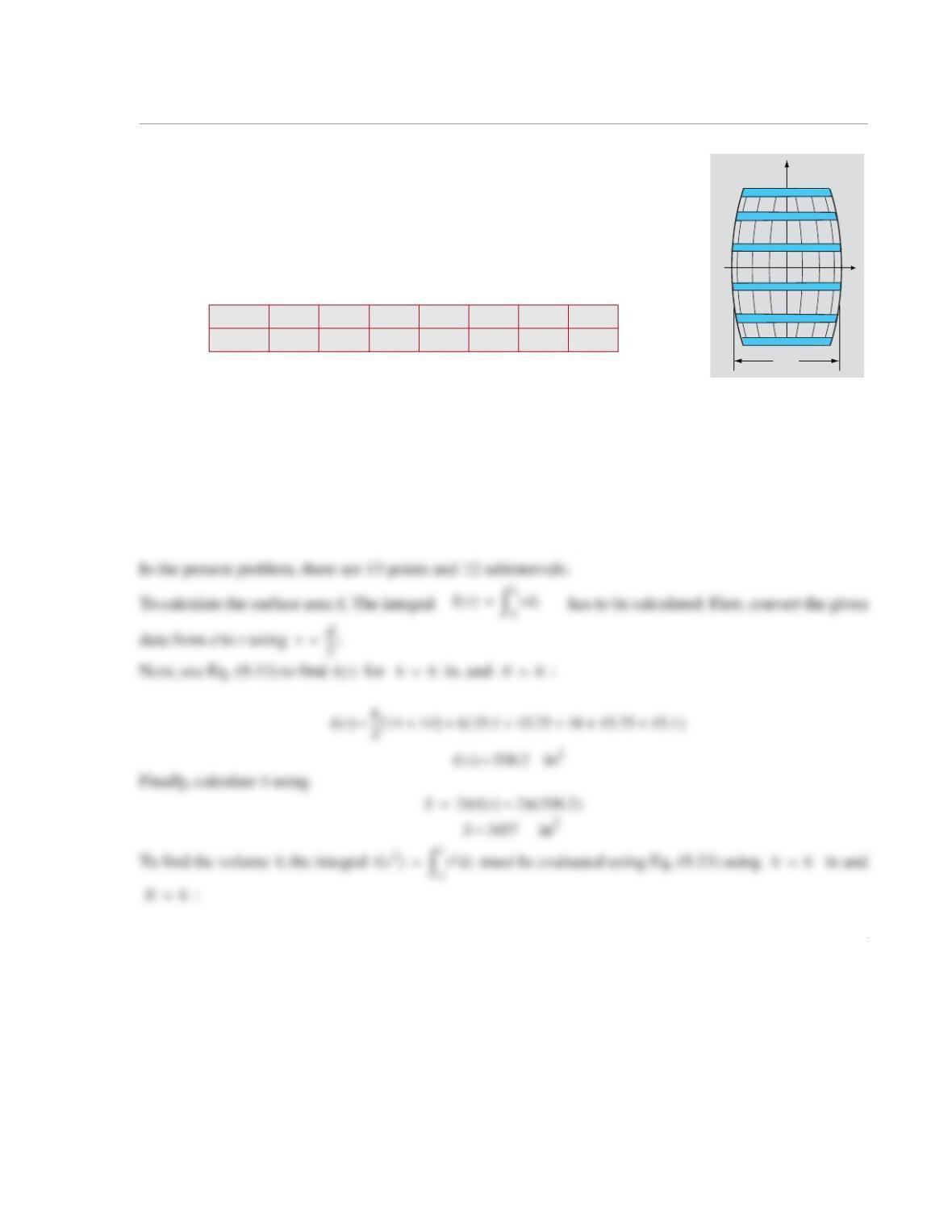
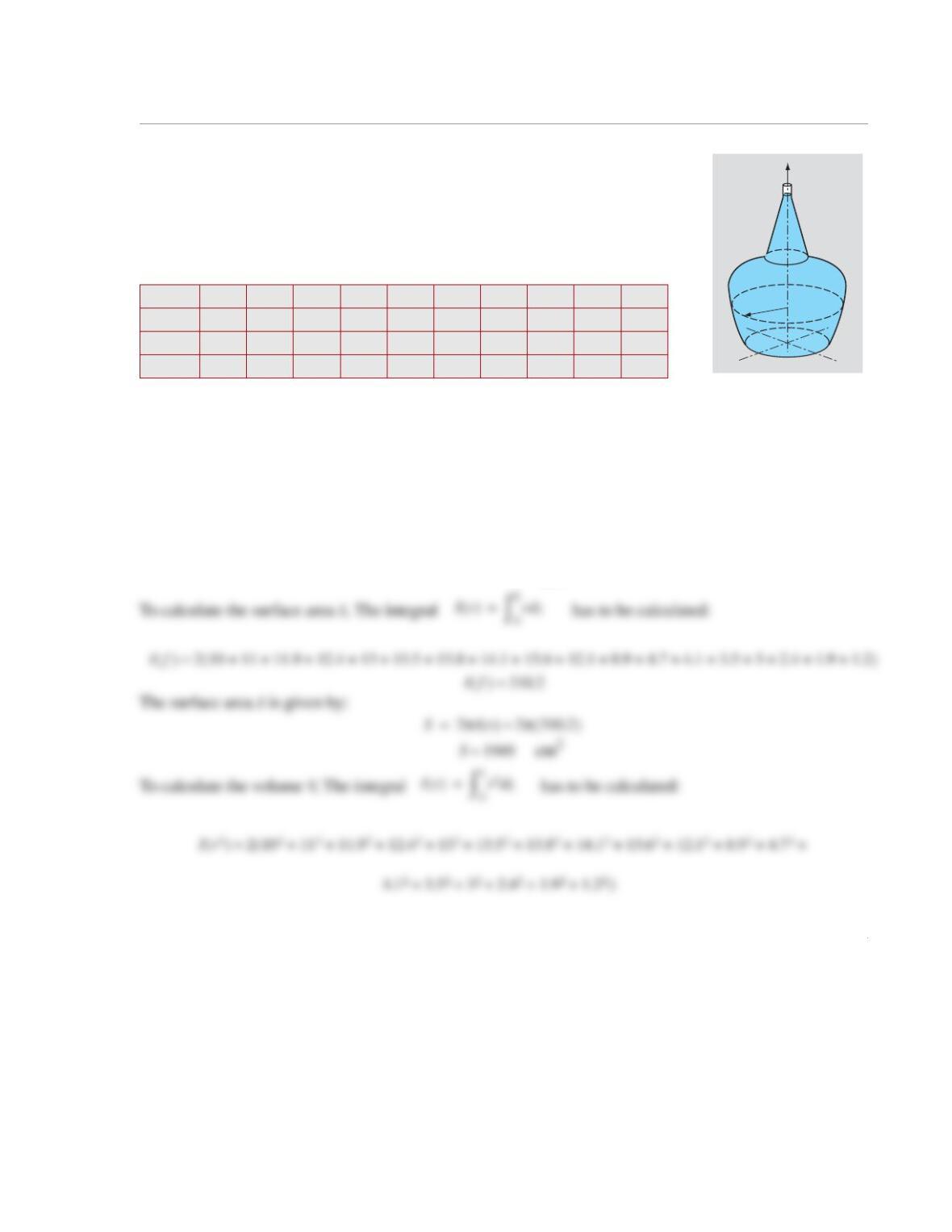
9.2 To estimate the surface area and volume of a wine barrel, the diameter of
the barrel is measured at different points along the barrel. The surface area, S,
and volume, V, can be determined by:
and
Use the data given in the table to determine the volume and surface area of the
barrel.
(a) Use the composite trapezoidal method.
(b) Use the composite Simpson’s 1/3 method.
(c) Use the composite Simpson’s 3/8 method.
Solution
(a) The composite trapezoidal method is given by Eq. (9.13):
z (in.) –18 –12 –6 0 6 12 18
d (in.) 28 30.2 31.5 32 31.5 30.2 28
d
z
x
S2πrzd
0
L
=
Vπr2zd
0
L
=
If() h
2
—–fa() fb()+
[]hfx
i
()
i2=
N
+≈

2
(b) The composite Simpson’s 1/3 method is given by Eq. (7.19):
In the present problem, there are 7 points and 6 subintervals. Note that the requirements given for Eq.
(9.19) are met. That is, the subintervals are equally spaced and of an even number.
To calculate the surface area S, The integral has to be calculated. First, convert the given data
from d to r using :Next, use Eq. (9.19) to find for in and :
h6=
If() h
3
—–fa() 4fx
i
()
i246,,=
N
2fx
j
()
j357,,=
N1–
fb()++ +≈
Ir() rzd
0
L
=
rd
2
—–
=
Ir()
h6=
N6=
Ir() 6
3
—–14415.11615.1++()2 15.75 15.75+()14+++[]≈
3
in3
(c) The composite Simpson’s 3/8 method is given by Eq. (9.22):
In the present problem, there are 7 points and 6 subintervals. Note that the requirements given for Eq.
(9.22) are met. That is, the subintervals are equally spaced and the number of sub intervals is divisible by
3.
To calculate the surface area S, The integral has to be calculated. First, convert the given data
from d to r using :
Next, use Eq. (9.22) to find for in and :
V26592.5≈
If() 3h
8
—––fa() 3fx
i
() fx
i1+
()+[]
i258,,=
N1–
2fx
j
()
j4710,,=
N2–
fb()+++≈
Ir() rzd
0
L
=
rd
2
—–
=
Ir()
h6=
N6=
If() 36⋅
8
———– 14 3 15.1 15.75 15.75 15.1+++()216()14+++()≈
1
9.3 To estimate the surface area and volume of a wine bottle, the radius of the
bottle is measured at different heights. The surface area, S, and volume, V, can be
determined by:
and
Use the data given below to determine the volume and surface area of the vase:
(a) Use the composite rectangle method.
(b) Use the composite trapezoidal method.
(c) Use the composite Simpson’s 3/8 method.
Solution
(a) The composite rectangle method is given by Eq. (9.4):
z (cm) 0 2 4 6 8 10 12 14 16 18
r (cm) 10 11 11.9 12.4 13 13.5 13.8 14.1 13.6 12.1
z (cm) 20 22 24 26 28 30 32 34 36
r (cm) 8.9 4.7 4.1 3.5 3.0 2.4 1.9 1.2 1.0
z
r
S2πrzd
0
L
=
Vπr2zd
0
L
=
If() fx()xd
a
b
hfx
i
()
i1=
N
≈=
2
The volume V is given by:
in3
cm3
To calculate the surface area S, The integral has to be calculated:
If() 3476.8≈
VπIr
2
() π3476.8≈=
10923
Ir() rzd
0
L
=
Ir() 2
2
—–10 1+[]2 11 11.9 12.4 13 13.5 13.8 14.1 13.6 12.1 8.9 4.7 4.1++++++++++++(+≈
3.5 3 2.4 1.9 1.2++ + + )
3
(c) The composite Simpson’s 3/8 method is given by Eq. (9.22):
In the present problem, there are 19 points and 18 subintervals. Note that the requirements given for Eq.
(9.22) are met. That is, the subintervals are equally spaced and the number of sub intervals is divisible by
3.
cm2
Finally, calculate S using
cm2
If() 3h
8
—––fa() 3fx
i
() fx
i1+
()+[]
i258,,=
N1–
2fx
j
()
j4710,,=
N2–
fb()+++≈
Ir() 301.125≈
S2πIr() 2π301.125()≈=
S1892≈
1
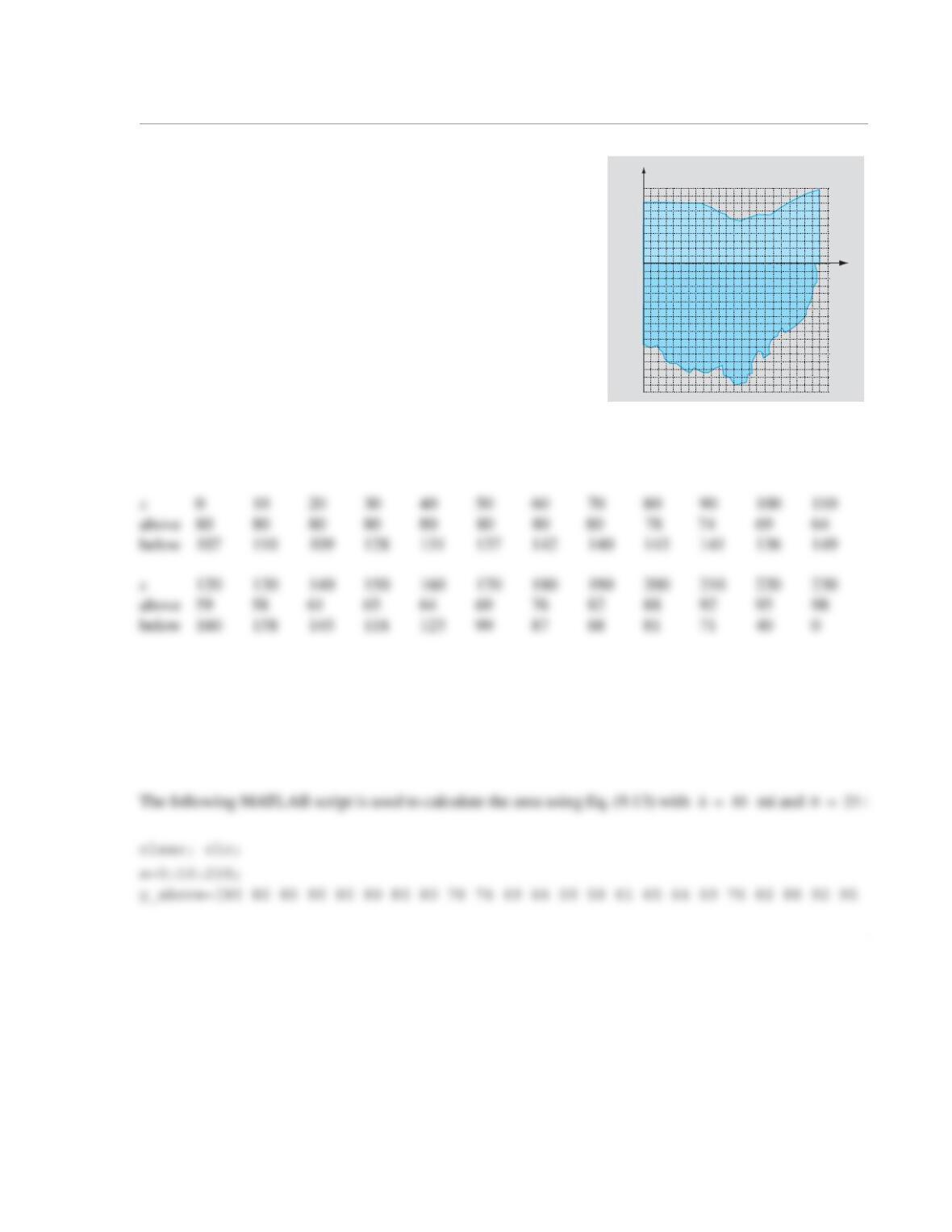
9.4 An approximate map of the state of Ohio is shown in the
figure. For determining the area of the state, the map is divided
into two parts (one above and one below the x-axis). Determine
the area of the state by numerically integrating the two areas. For
each part, make a list of the coordinate y of the border as a func-
tion of x. Start with and use increments of 10 mi, such that
the last point is mi.
Once the tabulated data is available, determine the inte-
grals once with the composite trapezoidal method.
Solution
The coordinates of the border y at 10-mile increments of x are as follows:
The area of the state is found by integrating the areas above and below the x-axis. Eq. (9.13) is used to inte-
grate using the composite trapezoidal method:
x
y
100
50 150100
50
200 [mi]
[mi]
-50
-100
x0=
x230=
If() h
2
—–fa() fb()+
[]hfx
i
()
i2=
N
+≈
2
98];
y_below=[107 110 109 128 131 137 142 140 143 141 136 149 160 158 145 118 123 99
87 88 81 71 40 0];
N=length(x)-1;
h=10; %mi, length of subinterval
When the above script is executed, the value of appears in the Command Window:
I =
44325
If()
1
9.5 The Head Severity Index (HSI) measures the risk of head injury in a car crash. It is calculated by:
where is the normalized acceleration (acceleration in m/s2 divided by 9.81 m/s2) and t is time in sec-
onds during a crash. The acceleration of a dummy head measured during a crash test is given in the follow-
ing table.
Determine the HSI.
(a) Use the composite trapezoidal method.
(b) Use the composite Simpson’s 1/3 method.
(c) Use the composite Simpson’s 3/8 method.
Solution
t (ms) 0 5 10 15 20 25 30 35 40 45 50 55 60
a (m/s2)03820 33 42 40 48 60 12 843
HSI a t()[]
2.5 td
0
t
=
at()
HSI a t()[]
2.5 td
t
=
2
1
9.6 Evaluate the integral
using the following methods:
(a) Simpson’s 1/3 method. Divide the whole interval into six subintervals.
(b) Simpson’s 3/8 method. Divide the whole interval into six subintervals.
The exact value of the integrals is . Compare the results and discuss the reasons for the differ–
ences.
Solution
(a) The composite Simpson’s 1/3 method is given by Eq. (9.19):
Ixsin2xd
0
π
=
Iπ2⁄=
If() h
3
—–fa() 4fx
i
()
i246,,=
N
2fx
j
()
j357,,=
N1–
fb()++ +≈
2
The integral is calculated in the following script file:
When the script is executed, the following result is displayed in the Command Window:
I =
1.570796326794896
1
9.7 Evaluate the integral
using the following methods:
(a) Simpson’s 1/3 method. Divide the whole interval into six subintervals.
(b) Simpson’s 3/8 method. Divide the whole interval into six subintervals.
The exact value of the integral is . Compare the results and discuss the reasons for the dif-
ferences.
Solution
(a) The composite Simpson’s 1/3 method is given by Eq. (9.19):
I2x
1x2
+
————-–xd
0
2.4
=
I169
25
——––ln=
If() h
3
—–fa() 4fx
i
()
i246,,=
N
2fx
j
()
j357,,=
N1–
fb()++ +≈
2
The integral is calculated in the following script file:
When the script is executed, the following result is displayed in the Command Window:
I =
1.915454442805341
Iexact =
1.911022890054873
If() 3h
8
—––fa() 3fx
i
() fx
i1+
()+[]
i258,,=
N1–
2fx
j
()
j4710,,=
N2–
fb()+++≈
1
9.8 Evaluate the integral in Problem 9.7 using
(a) three-point Gauss quadrature;
(b) four-point Gauss quadrature.
Solution
The coefficients and Gauss points for second-order Gauss quadrature are given in Table 9-1 and are
valid if the range of integration is . Because the range of integration in the present problem is
, the integral must be rewritten according to Eq. (9.31):
1–1,[]
02.4,[]
2
(b) The three-point Gauss quadrature formula is:
When the script is executed, the following answer isplayed in the Command Window:
I =
1.910412005251985
fx()xd
1
C1fx
1
()C2fx
2
()C3fx
3
()C4fx
4
()+++≈