22 PUBLIC LAND SURVEYS
22.1* Convert 41.3 chains to feet.
22.2 What is meant by the term public lands?
22.3 In what states are public land surveys not applicable?
22.4 Define aliquot part.
22.5 Why are the boundaries of the public lands established by duly appointed surveyors
unchangeable, even though incorrectly set in the original surveys?
22.6 What is the convergence in feet of meridians for the following conditions:
22.7 What is the angular convergence, in seconds, for the two meridians defining a township
exterior at mean latitude of:
22.8 What is the nominal distance in miles between the following?
22.9 Define a range in the public land survey system.
22.11 SE1/4, NW1/4, Sec. 13, T1N, R2E, Fairbanks PM. 40 ac with sketch
22.13 What are the nominal dimensions and acreages of the following parcels:
22.14 How many rods of fence are required to enclose the following:
(a)* A parcel including the NE 1/4, NE 1/4, Sec. 32, and the NW 1/4, NW 1/4, Sec. 33,
T 2 N, R 3 E?
(b) A parcel consisting of Secs. 22, 23, 26, and 27 of T2N, R1W?
22.15 What lines of the U.S. public-land system were run as random lines?
22.16 In subdividing a township, which section line is run first? Which last?
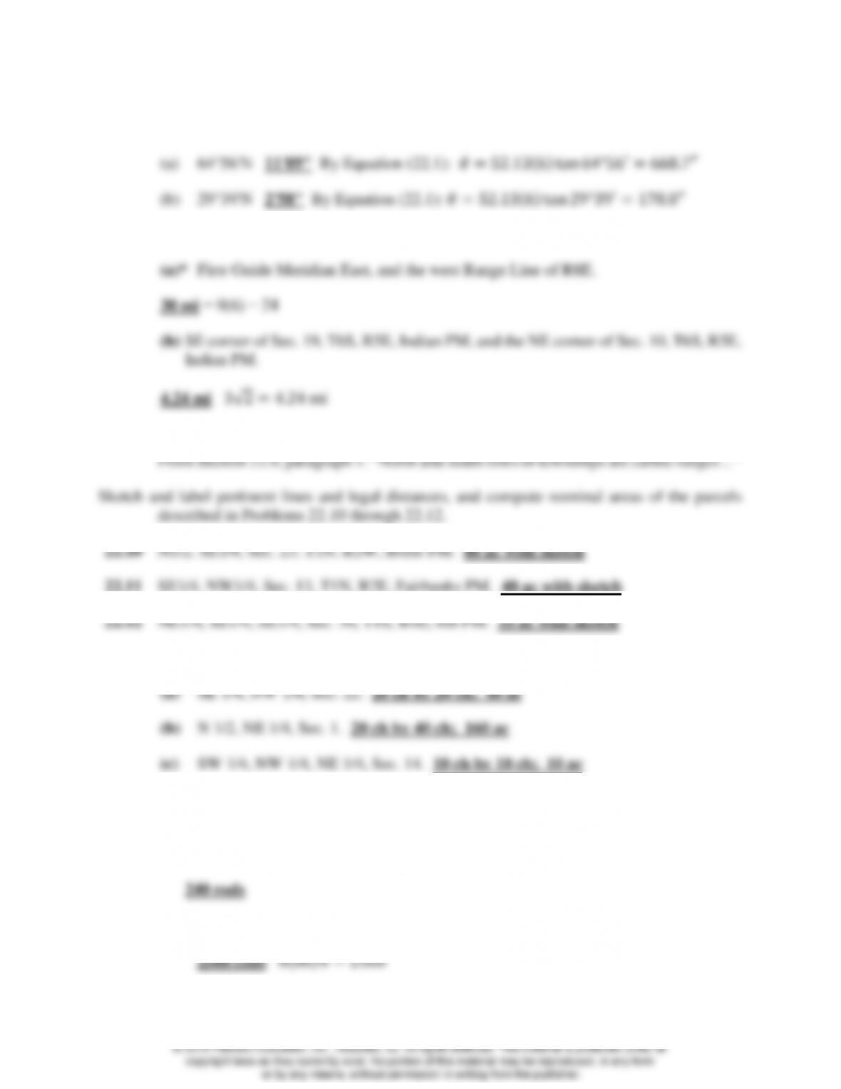
22.17 Corners of the SE 1/4 of the NW 1/4 of Sec. 22 are to be
monumented. If all section and quarter-section corners
originally set are in place, explain the procedure to follow,
and sketch all lines to be run and corners set.
22.18 The quarter-section corner between Secs. 15 and 16 is found to be 40.28 ch from the
corner common to Secs. 9, 10, 15, and 16. Where should the quarter-quarter-section
corner be set along this line in subdividing Sec. 15?
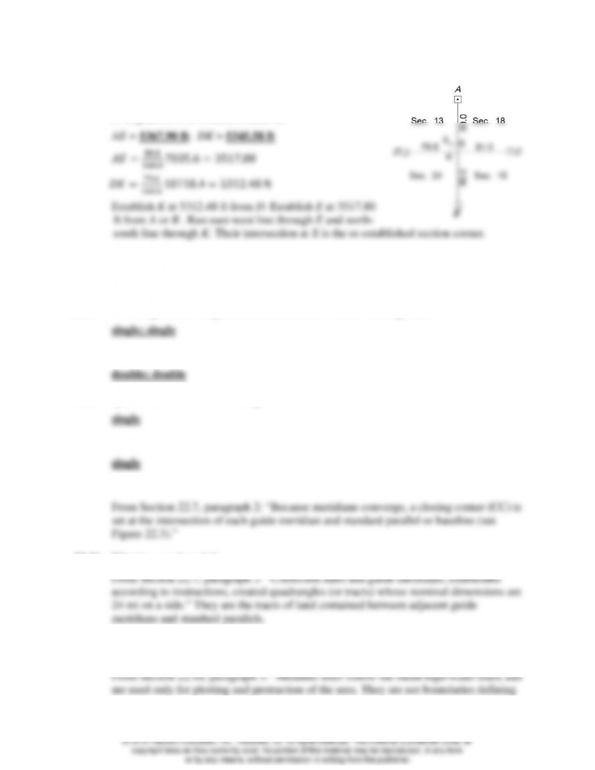
22.19 As shown in the figure, in a normal township the exterior
dimensions of Sec. 6 on the west, north, east, and south
sides are 81, 78, 82, and 79 ch, respectively. Explain with
a sketch how to divide the section into quarter sections.
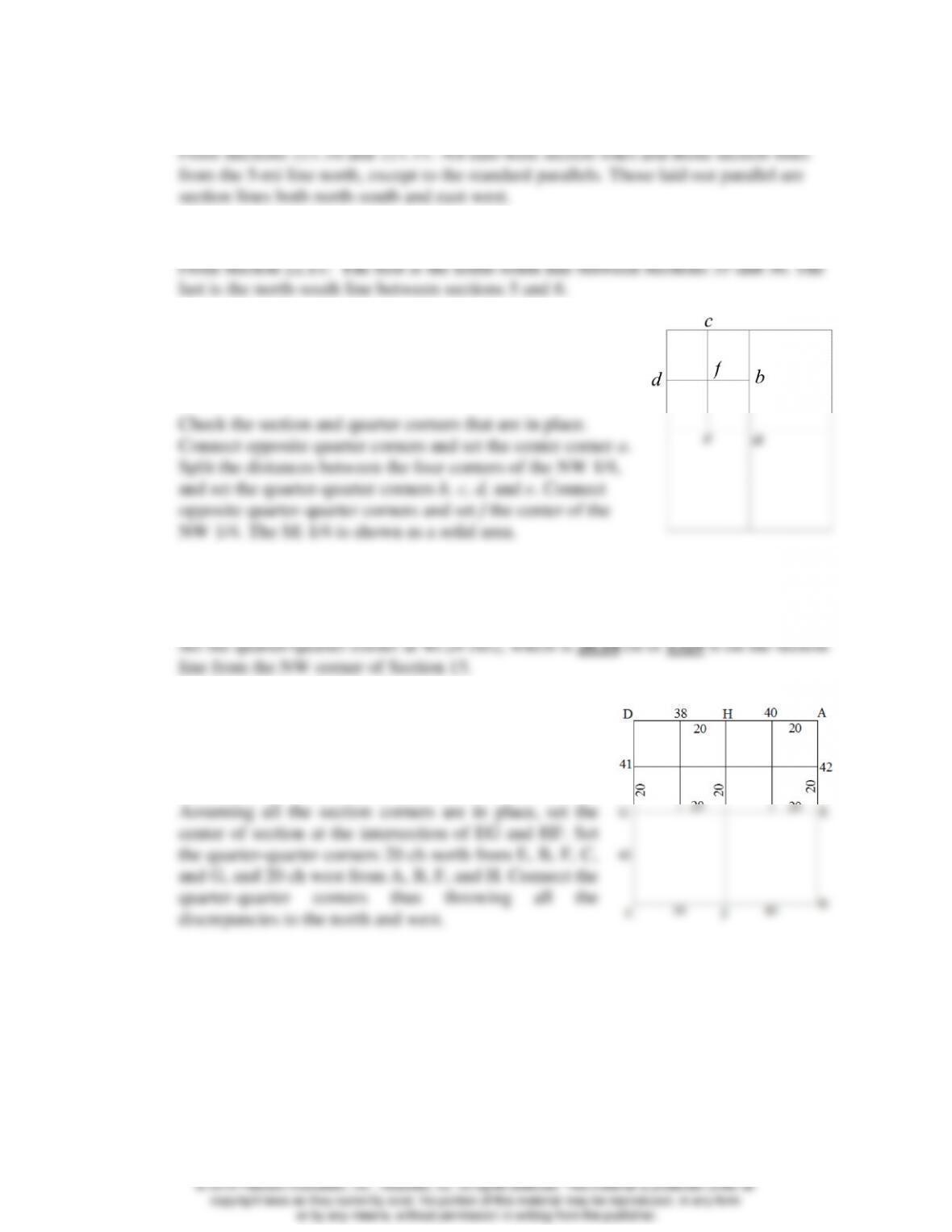
22.20 The problem figure shows original record distances.
Corners A, B, C, and D are found, but corner E is lost.
Measured distances are AB = 7035.6 ft and CD = 10,718.4
ft. Explain how to establish corner E.
To restore the corners in Problems 22.21 through 22.24, which method is used, single
proportion or double proportion?
22.21* Township corners on guide meridians; section corners on range lines
22.22 Section corners on section lines; township corners on township lines.
22.23 Quarter-section corners on range lines.
22.24 Quarter-quarter-section corners on section lines.
22.25 What is a closing corner?
22.26 What is a quadrangle?
22.27 Why are meander lines not accepted as the boundaries defining the ownership of lands
adjacent to a stream or
22.28 The southern boundary of a township lies on a standard parallel at latitude 38°30′N. What
is the theoretical length of its northern boundary?
22.29 Why are the areas of many public-lands sections smaller than the nominal size?
22.30 Visit the NILS web site and briefly describe the four components of NILS.
22.31 Visit the BLM website at http://www.blm.gov/wo/st/en/prog/more/nils.html, and prepare
a paper on the NILS project.
Individual report.
© 2018 Pearson Education, Inc., Hoboken, NJ. All rights reserved. This material is protected under all

© 2018 Pearson Education, Inc., Hoboken, NJ. All rights reserved. This material is protected under all