
Match the wave characteristics with the correct definition.
A) The vertical distance between the trough and the crest
B) The time it takes for one full wave to pass a given point
C) The horizontal distance between successive crests
5) Wave height
Diff: 1
Bloom’s Taxonomy: Knowledge
Global Sci Out: 7
Section: 20.2 – Waves
Focus/Concepts: 20.2
Earth Science LO: 5.6 – Water shapes landscapes.
6) Wavelength
Diff: 1
Bloom’s Taxonomy: Knowledge
Global Sci Out: 7
Section: 20.2 – Waves
Focus/Concepts: 20.2
Earth Science LO: 5.6 – Water shapes landscapes.
7) Wave Period
Diff: 1
Bloom’s Taxonomy: Knowledge
Global Sci Out: 7
Section: 20.2 – Waves
Focus/Concepts: 20.2
Earth Science LO: 5.6 – Water shapes landscapes.

22
Match the shoreline feature with the correct definition.
A) Ridge of sand that connects the mainland to an island
B) Elongated ridge of sand projecting out into a bay
C) An isolated rock column left behind after the collapse of a sea arch
D) Bench created by waves crashing into a cliff
E) A sandbar that completely crosses a bay
8) Sea Stack
Diff: 1
Bloom’s Taxonomy: Knowledge
Global Sci Out: 7
Section: 20.4 – Shoreline Features
Focus/Concepts: 20.4
Earth Science LO: 4.8 – Weathered and unstable rock materials erode from some parts of Earth’s
surface and are deposited in others.
9) Tombolo
Diff: 1
Bloom’s Taxonomy: Knowledge
Global Sci Out: 7
Section: 20.4 – Shoreline Features
Focus/Concepts: 20.4
Earth Science LO: 4.8 – Weathered and unstable rock materials erode from some parts of Earth’s
surface and are deposited in others.
10) Wave-cut platform
Diff: 1
Bloom’s Taxonomy: Knowledge
Global Sci Out: 7
Section: 20.4 – Shoreline Features
Focus/Concepts: 20.4
Earth Science LO: 4.8 – Weathered and unstable rock materials erode from some parts of Earth’s
surface and are deposited in others.
11) Spit
Diff: 1
Bloom’s Taxonomy: Knowledge
Global Sci Out: 7
Section: 20.4 – Shoreline Features
Focus/Concepts: 20.4
Earth Science LO: 4.8 – Weathered and unstable rock materials erode from some parts of Earth’s
surface and are deposited in others.

12) Baymouth Bar
Diff: 1
Bloom’s Taxonomy: Knowledge
Global Sci Out: 7
Section: 20.4 – Shoreline Features
Focus/Concepts: 20.4
Earth Science LO: 4.8 – Weathered and unstable rock materials erode from some parts of Earth’s
surface and are deposited in others.

Using the choices provided, identify the erosional features and the depositional features.
A) Erosional
B) Depositional
13) Sea Arch
Diff: 1
Bloom’s Taxonomy: Comprehension
Global Sci Out: 2
Section: 20.4 – Shoreline Features
Focus/Concepts: 20.4
Earth Science LO: 4.8 – Weathered and unstable rock materials erode from some parts of Earth’s
surface and are deposited in others.
14) Barrier Island
Diff: 1
Bloom’s Taxonomy: Comprehension
Global Sci Out: 2
Section: 20.4 – Shoreline Features
Focus/Concepts: 20.4
Earth Science LO: 4.8 – Weathered and unstable rock materials erode from some parts of Earth’s
surface and are deposited in others.
15) Marine Terrace
Diff: 1
Bloom’s Taxonomy: Comprehension
Global Sci Out: 2
Section: 20.4 – Shoreline Features
Focus/Concepts: 20.4
Earth Science LO: 4.8 – Weathered and unstable rock materials erode from some parts of Earth’s
surface and are deposited in others.
16) Spit
Diff: 1
Bloom’s Taxonomy: Comprehension
Global Sci Out: 2
Section: 20.4 – Shoreline Features
Focus/Concepts: 20.4
Earth Science LO: 4.8 – Weathered and unstable rock materials erode from some parts of Earth’s
surface and are deposited in others.

Below are several development policies for coastal properties with considerations for coastal
stabilization. Match those development policies with the expected costs and effectiveness of each
method.
A) Extensive coastal development protected by massive, hardened structures able to withstand
all but the most powerful storm waves
B) All coastal development prohibited and no coastal stabilization methods taken
C) Some coastal development allowed, but the beach is maintained through long-term beach
nourishment techniques
17) Low start-up costs, but modest maintenance costs. Potential for storm damage is high with
low to moderate potential for negative environmental effects
Diff: 3
Bloom’s Taxonomy: Comprehension
Global Sci Out: 2
Section: 20.5 – Stabilizing the Shore & 20.6 – Erosion Problems Along U.S. Coasts
Focus/Concepts: 20.5 & 20.6
Earth Science LO: 9.1 – Human activities significantly change the rates of many of Earth’s
surface processes.
18) High start up and (eventually) maintenance costs. High potential for storm damages and for
negative environmental effects
Diff: 3
Bloom’s Taxonomy: Comprehension
Global Sci Out: 2
Section: 20.5 – Stabilizing the Shore & 20.6 – Erosion Problems Along U.S. Coasts
Focus/Concepts: 20.5 & 20.6
Earth Science LO: 9.1 – Human activities significantly change the rates of many of Earth’s
surface processes.
19) Low start-up costs and maintenance costs. Potential for storm damages and negative
environmental consequences are low
Diff: 3
Bloom’s Taxonomy: Comprehension
Global Sci Out: 2
Section: 20.5 – Stabilizing the Shore & 20.6 – Erosion Problems Along U.S. Coasts
Focus/Concepts: 20.5 & 20.6
Earth Science LO: 9.1 – Human activities significantly change the rates of many of Earth’s
surface processes.

26
Match the type of tide/tidal pattern with the correct definition.
A) Highest high tides and lowest low tides of the month
B) Single high and single low tide every day
C) Two high tides and two low tides each day, but with different high tide levels and different
low tide levels
D) Highest low tides and lowest high tides of the month
E) Two high of roughly the same height and two low tides of roughly the same height each day
20) Neap Tide
Diff: 1
Bloom’s Taxonomy: Knowledge
Global Sci Out: 7
Section: 20.9 – Tides
Focus/Concepts: 20.9
Earth Science LO: 5.6 – Water shapes landscapes.
21) Spring Tide
Diff: 1
Bloom’s Taxonomy: Knowledge
Global Sci Out: 7
Section: 20.9 – Tides
Focus/Concepts: 20.9
Earth Science LO: 5.6 – Water shapes landscapes.
22) Diurnal Tidal Pattern
Diff: 1
Bloom’s Taxonomy: Knowledge
Global Sci Out: 7
Section: 20.9 – Tides
Focus/Concepts: 20.9
Earth Science LO: 5.6 – Water shapes landscapes.
23) Mixed Tidal Pattern
Diff: 1
Bloom’s Taxonomy: Knowledge
Global Sci Out: 7
Section: 20.9 – Tides
Focus/Concepts: 20.9
Earth Science LO: 5.6 – Water shapes landscapes.

24) Semidiurnal Tidal Pattern
Diff: 1
Bloom’s Taxonomy: Knowledge
Global Sci Out: 7
Section: 20.9 – Tides
Focus/Concepts: 20.9
Earth Science LO: 5.6 – Water shapes landscapes.
20.5 Essay Questions
1) Evaluate the accuracy of the following: Shorelines are temporary geologic and topographic
features.
2) Explain why waves will begin to curl and fall over as they approach shore.
3) What combination of incoming waves and backwash will result in a longshore drift? Explain.
5) Explain how the construction of a hard stabilization feature (i.e. groin) will force the
deposition of sediment on a coastline.
6) Compare and contrast the effectiveness of hard stabilization methods to control coastal
erosion versus alternative shoreline management techniques. Which do you think would be most
effective?

7) Rivers in the Pacific Northwest are heavily managed by the construction of dams and
reservoirs in order to produce hydroelectric power and, in some areas, for irrigation. However,
the construction of interior dams can have serious consequences for the coastal erosion of
beaches and rocky bluffs along the Pacific Coast. How can the construction of these dams lead to
the erosion of a rocky coastal bluff?
8) How would coastline composition (rocky versus sandy) differ from an active continental
margin to a passive continental margin?

9) The Mississippi River is one of the most intensely managed rivers in the United States. The
Upper Mississippi is restrained by over thirty locks and dams. The Lower Mississippi is lined
with levees. Now, consider the Gulf Coast of the United States. It is acknowledged that coastal
swamps and marshes are important controls of storm surge from hurricanes. However, due to a
combination of wave erosion and development, the coastal marshes are being lost. What role
does the Mississippi River play in maintenance or loss of coastal marshes? Now, assume that the
Army Corps of Engineers, who regulates river and coastal structures, has a difficult decision to
make: keep the locks, dams, and levees on the Mississippi and protect shipping and floodplains
or remove those structures from the Mississippi and put efforts into protecting the coastline from
hurricanes. Which decision do you believe would have the greatest benefit and why?
10) How does the rotation of the earth give coastlines a high tide and a low tide?
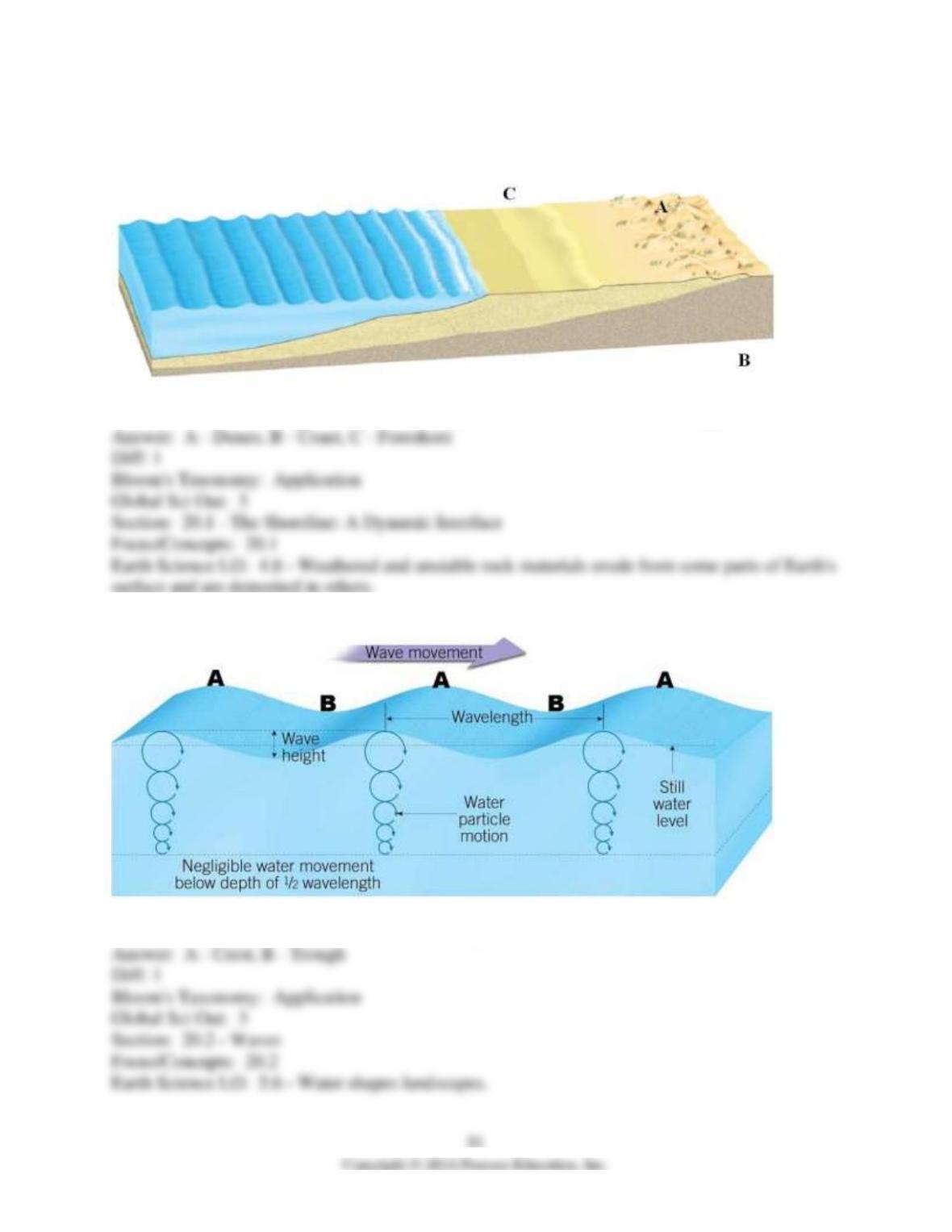
20.6 Visual
1)
Identify the three missing terms from the diagram of the coastal area in this image.
2)
Identify the parts of the wave labeled in this image.
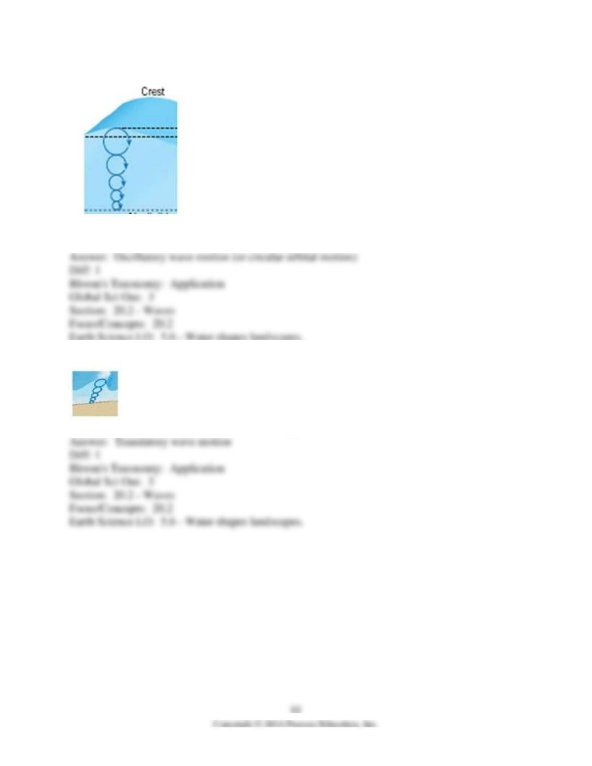
3)
What kind of wave motion is visible in this image?
4)
What kind of wave motion is visible in this image?
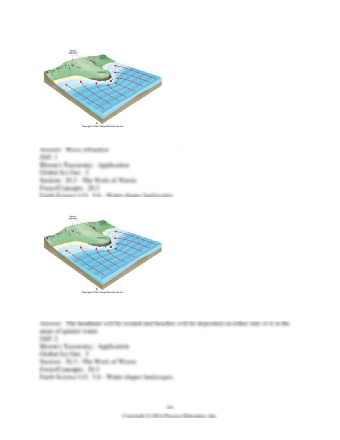
5)
What process is illustrated by the arrows in this image?
6)
Indicate on this image which areas will be dominated by deposition and which will be dominated
by erosion.
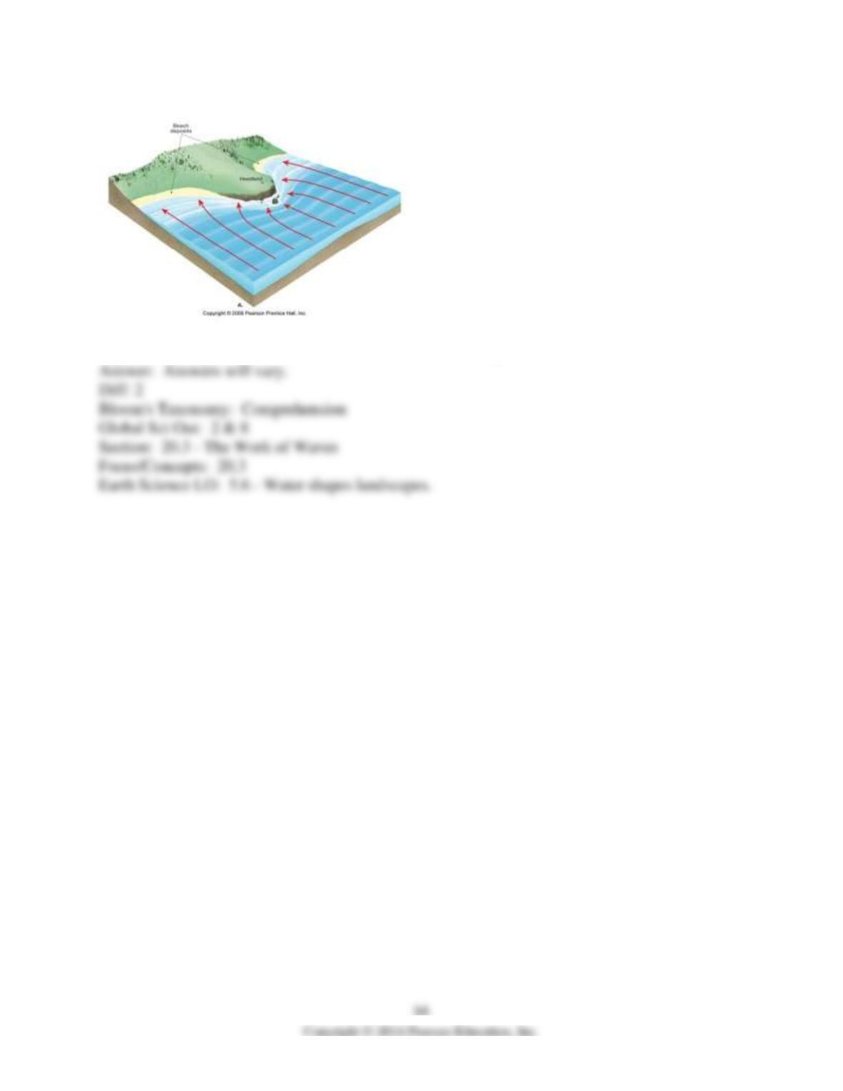
7)
Explain why deposition or erosion would occur at the areas you indicated.
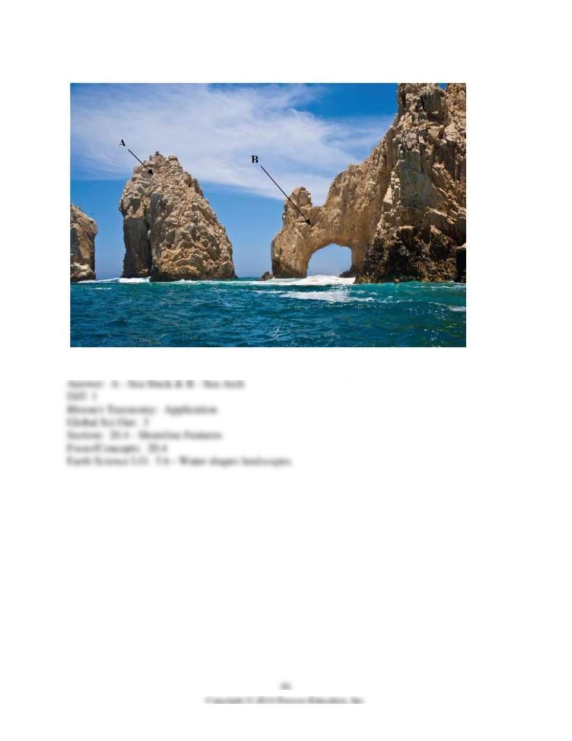
8)
What erosional features, marked A and B, are visible in this figure?
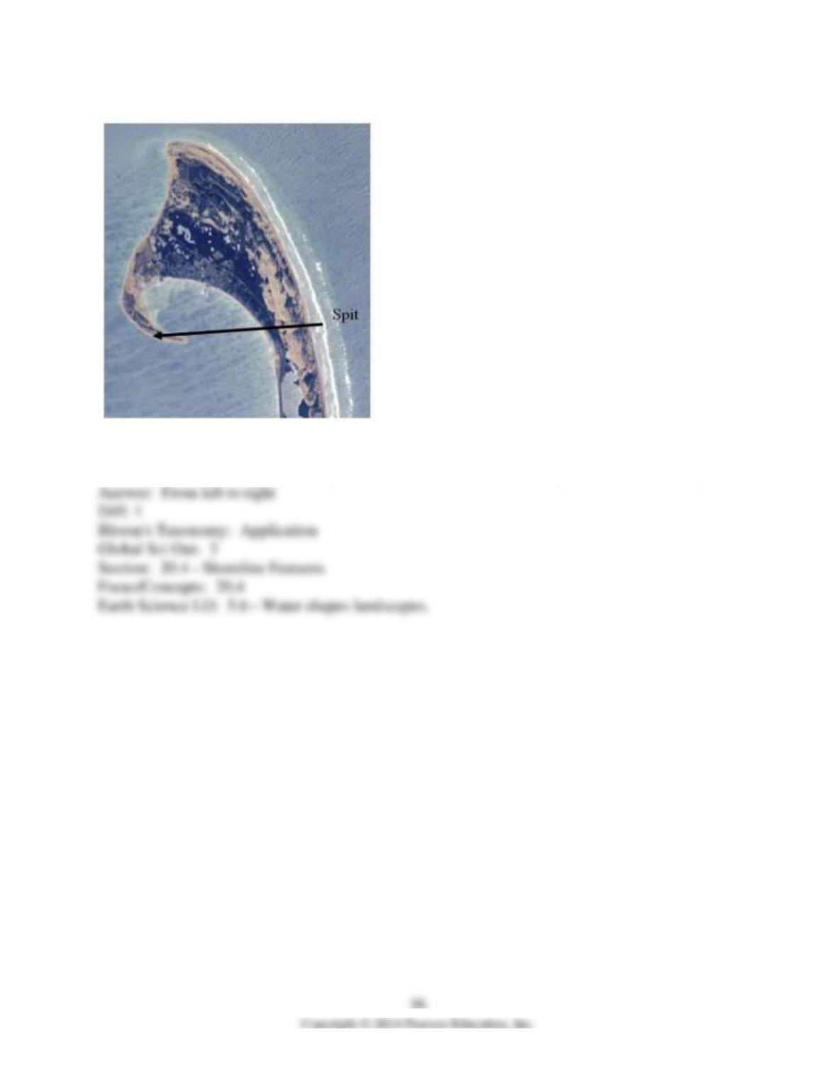
9)
This image contains a spit, which is identified by an arrow. (The arrow is only for identification
purposes.) Using the shape of the spit, from which direction is the longshore current coming?
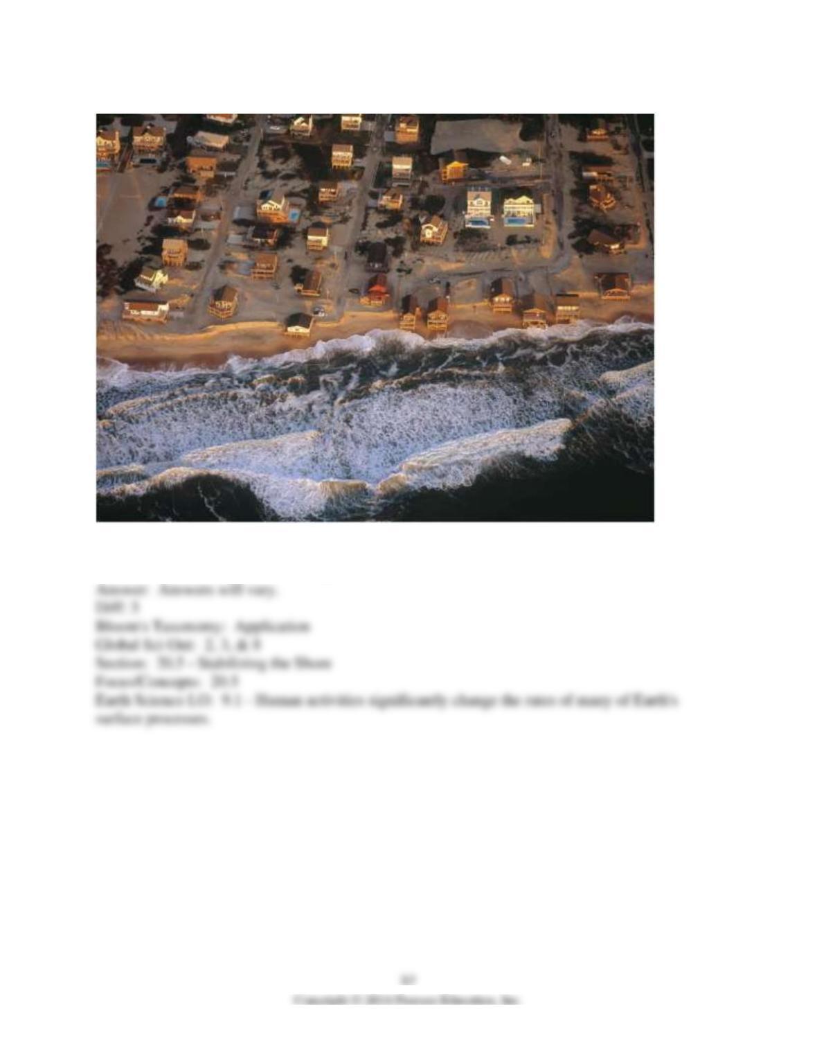
10)
The beachfront houses in this image are being threatened by coastal erosion. Propose three ways
the houses could be saved. Which option do think that a cost-conscious homeowner would take?
11)
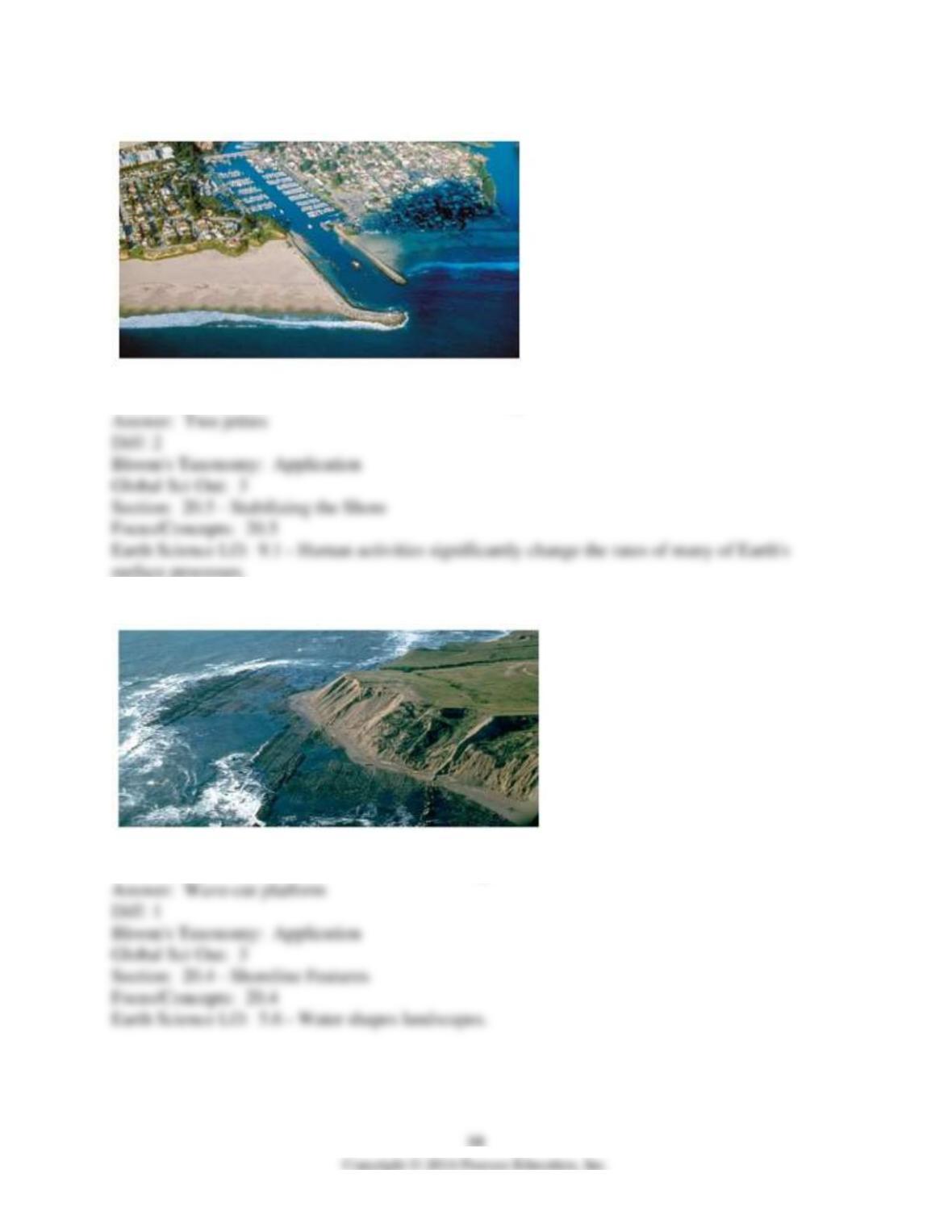
What coastal erosion stabilizers are visible in this image?
12)
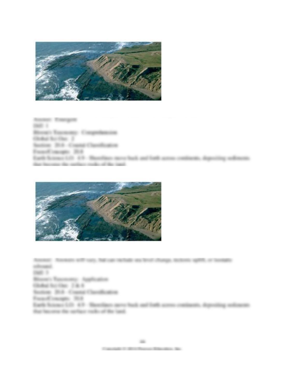
What coastal erosion feature is visible in this image?
13)
Is this feature evidence of an emergent coastline or a submergent coastline?
14)
Develop three scenarios that may result in the exposure of the feature in this image.