
Match the landform with the correct description.
A) Formed by mountain streams emerging onto a flat plain
B) Small deposits that form in the stream channel
C) Form where streams enter large lakes or oceans
D) Formed by floodwaters on either side of a stream
4) Delta
Diff: 1
Bloom’s Taxonomy: Knowledge
Global Sci Out: 7
Section: 16.7 – Depositional Landforms
Focus/Concepts: 16.7
Earth Science LO: 5.6 – Water shapes landscapes.
5) Levee
Diff: 1
Bloom’s Taxonomy: Knowledge
Global Sci Out: 7
Section: 16.7 – Depositional Landforms
Focus/Concepts: 16.7
Earth Science LO: 5.6 – Water shapes landscapes.
6) Alluvial Fan
Diff: 1
Bloom’s Taxonomy: Knowledge
Global Sci Out: 7
Section: 16.7 – Depositional Landforms
Focus/Concepts: 16.7
Earth Science LO: 5.6 – Water shapes landscapes.
7) Bar
Diff: 1
Bloom’s Taxonomy: Knowledge
Global Sci Out: 7
Section: 16.7 – Depositional Landforms
Focus/Concepts: 16.7
Earth Science LO: 5.6 – Water shapes landscapes.
22
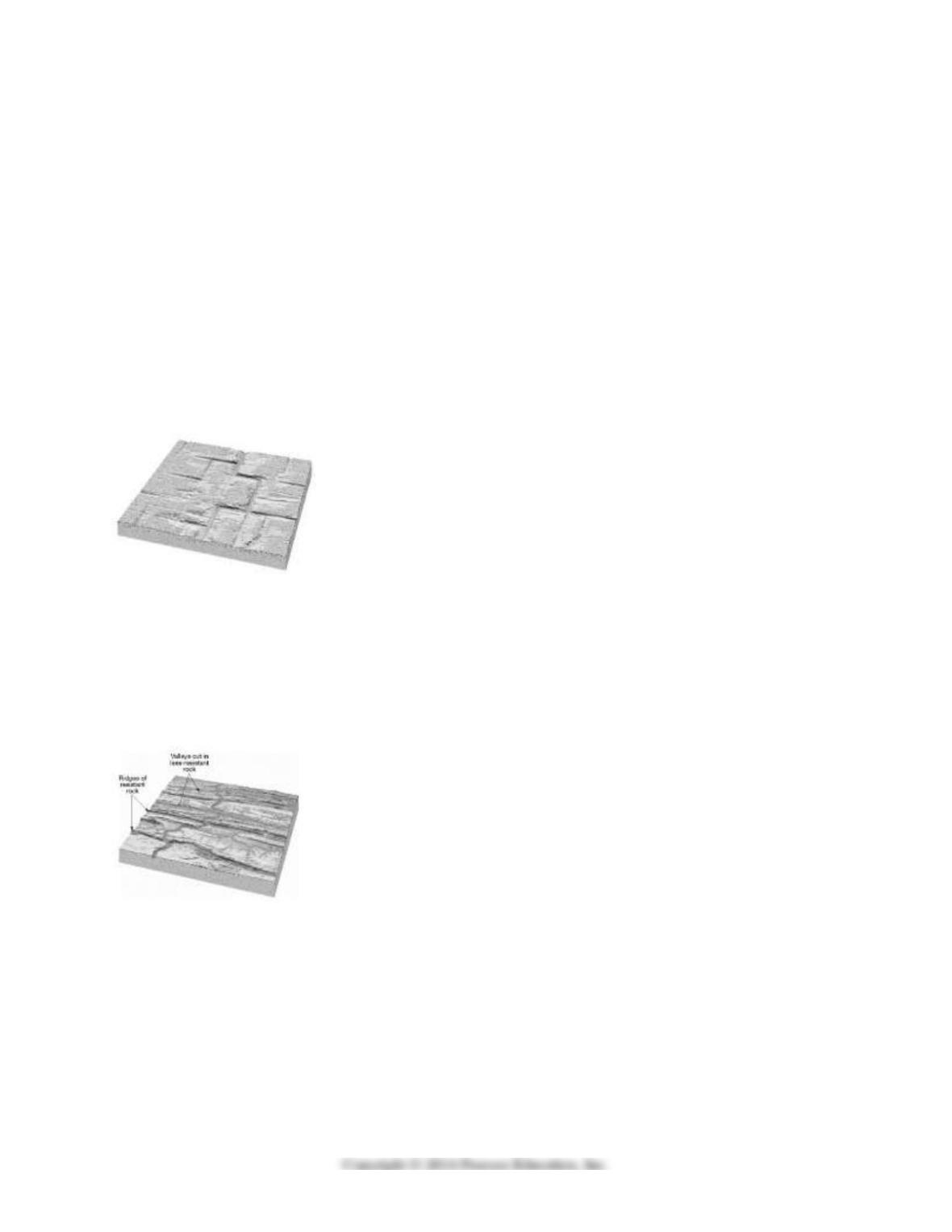
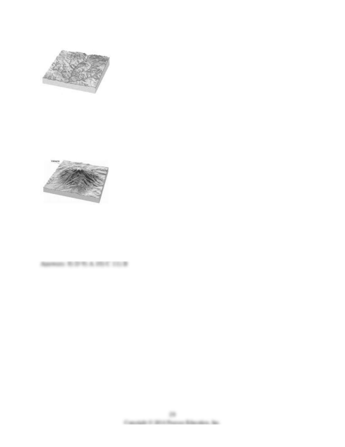
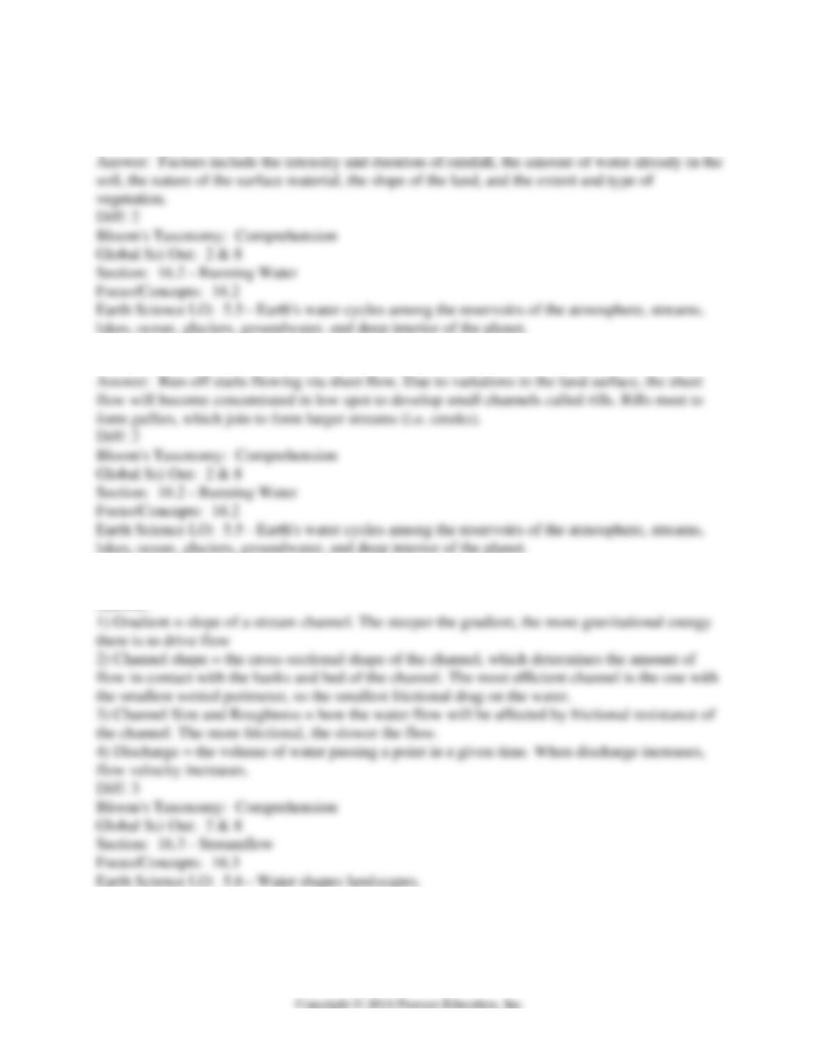
Identify the stream drainage pattern with the correct name: Radial, Rectangular, Trellis, or
Dendritic. Also, in the space provided, describe what this drainage pattern indicates about the
underlying geology.
A) Drainage Pattern: Trellis
Underlying Geology: Alternating resistant and less resistant materials that have been tilted or
folded
B) Drainage Pattern: Radial
Underlying Geology: Topographic high in center of drainage pattern
C) Drainage Pattern: Dendritic
Underlying Geology: Underlying rock is relatively uniform
D) Drainage Pattern: Rectangular
Underlying Geology: Fractured bedrock
8)
Diff: 2
Bloom’s Taxonomy: Comprehension
Global Sci Out: 2
Section: 16.8 – Drainage Patterns
Focus/Concepts: 16.8
Earth Science LO: 5.6 – Water shapes landscapes.
9)
Diff: 2
Bloom’s Taxonomy: Comprehension
Global Sci Out: 2
Section: 16.8 – Drainage Patterns
Focus/Concepts: 16.8
Earth Science LO: 5.6 – Water shapes landscapes.
10)
Diff: 2
Bloom’s Taxonomy: Comprehension
Global Sci Out: 2
Section: 16.8 – Drainage Patterns
Focus/Concepts: 16.8
Earth Science LO: 5.6 – Water shapes landscapes.
11)
Diff: 2
Bloom’s Taxonomy: Comprehension
Global Sci Out: 2
Section: 16.8 – Drainage Patterns
Focus/Concepts: 16.8
Earth Science LO: 5.6 – Water shapes landscapes.

Match the type of flood with the correct definition.
A) Floods with high precipitation in a short time
B) Seasonal Floods
C) Frozen material creates a temporary dam on a thawing river
D) Artificial containment structures fail
12) Ice-Jam Floods
Diff: 1
Bloom’s Taxonomy: Knowledge
Global Sci Out: 7
Section: 16.9 – Floods and Flood Control
Focus/Concepts: 16.9
Earth Science LO: 8.1 – Natural hazards result from natural Earth processes & 9.1 – Human
activities significantly change the rates of many of Earth’s surface processes.
13) Dam-Failure Floods
Diff: 1
Bloom’s Taxonomy: Knowledge
Global Sci Out: 7
Section: 16.9 – Floods and Flood Control
Focus/Concepts: 16.9
Earth Science LO: 8.1 – Natural hazards result from natural Earth processes & 9.1 – Human
activities significantly change the rates of many of Earth’s surface processes.
14) Regional Floods
Diff: 1
Bloom’s Taxonomy: Knowledge
Global Sci Out: 7
Section: 16.9 – Floods and Flood Control
Focus/Concepts: 16.9
Earth Science LO: 8.1 – Natural hazards result from natural Earth processes & 9.1 – Human
activities significantly change the rates of many of Earth’s surface processes.
15) Flash Floods
Diff: 1
Bloom’s Taxonomy: Knowledge
Global Sci Out: 7
Section: 16.9 – Floods and Flood Control
Focus/Concepts: 16.9
Earth Science LO: 8.1 – Natural hazards result from natural Earth processes & 9.1 – Human
activities significantly change the rates of many of Earth’s surface processes.
25
16.5 Essay Questions
1) What factors determine whether precipitation will become running water or infiltrate?
2) Explain how precipitation run-off will eventually become a stream.
3) What are the four factors that affect stream velocity and how will they affect the flow?
Answer:

4) Compare and contrast the water velocity and type of streamflow in a rocky mountain stream
versus a silt-bottomed stream along the Gulf Coast.
5) In the late spring and summer of 2012, the majority of the United States experienced a severe
drought, which damaged crops and affected barge traffic on major rivers. How did the drought
reduce barge traffic? How did the drought affect the factors that determine streamflow? What are
three ways that rivers lost water to the drought? (Hint: Where did the water go?)
6) The Upper Mississippi River and the Lower Mississippi River have very different stream
morphologies due in part because of the geology of the two regions. What is the basic geology of
each region (What material is the river flowing over?), how does the geology control the river,
and what is the morphology of the river as a result?
7) A dam is constructed on the Crymea River. Explain how this will affect the river and the work
that the river performs both upstream as well as downstream.
8) Explain the processes necessary to form a bird’s-foot delta such as that on the Mississippi
River.
9) When Europeans moved into the region along the Lower Mississippi River around three
hundred years ago, they often settled on the floodplains of the river and set up farms. If settlers
knew the land flooded, why might they have chosen to settle there?
10) After the arrival of European settlers on the Lower Mississippi, residents constructed levees
along the river to protect their homes and farmlands from periodic flooding as well as to keep the
channel open to navigation. Now, residents have problems with land subsidence, wave erosion,
land fertility, and increased severity of floods and hurricanes, particularly in the Delta area of
southern Louisiana. Why would the construction of artificial levees result in these problems?
11) Compare and contrast various flood control measures and their overall effectiveness.
12) Davenport, Iowa and Rock Island, Illinois are two of the Quad Cities, a bi-state metropolitan
area location in eastern Iowa and northwestern Illinois that spans the Mississippi River. As with
any river, the Mississippi River is prone to floods and can cause millions of dollars worth of
damage as well as disrupt barge traffic for weeks. Both cities have large segments of their
business districts in the floodplains. However, Rock Island has a levee protecting their business
district and Davenport does not, citing the desire the preserve their river views and “taking the
financial burden” of the flood so smaller river towns downstream do not have to. Davenport’s
lack of floodwall is a point of contention for many in the region, who tire of impairment and
repair to the business district, and some believe Davenport’s stance to be irresponsible. Which
side do you believe to be correct: Davenport and its no-levee stance or Rock Island and its pro-
levee stance? Explain.
16.6 Visual
1)
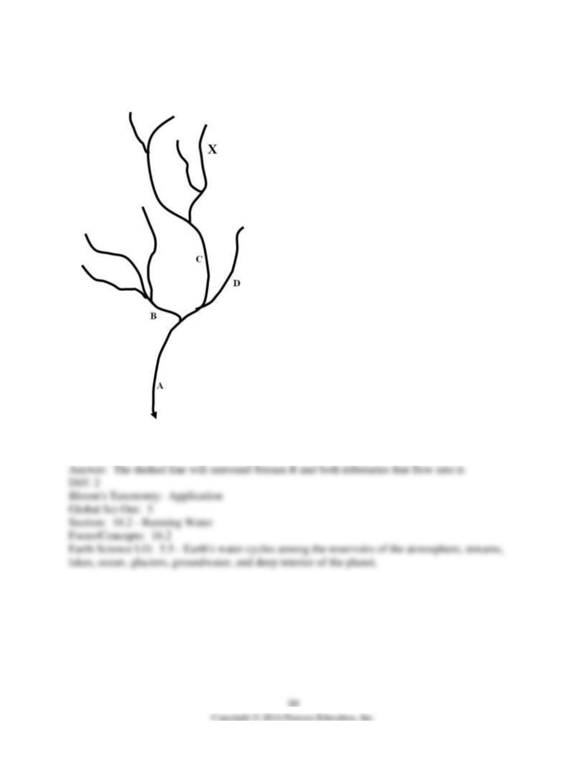
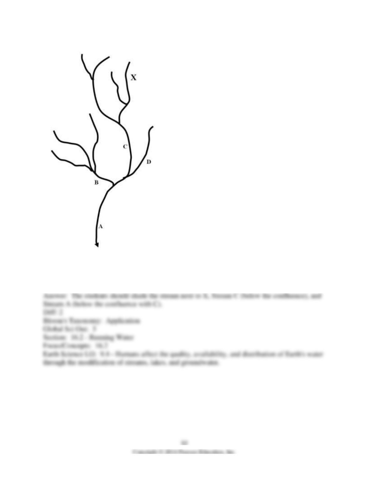
This image shows Stream A and all the tributaries that flow into it. Using a dashed line, draw the
drainage basin for Stream B.
2)
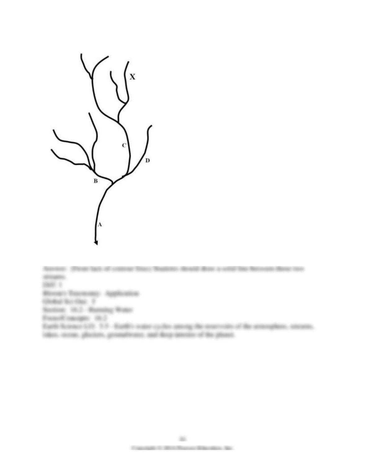
Using a solid line, draw a drainage divide between streams C and D.
3)
X marks the site of oil drums that were illegally buried by the Shay-Dee Oil Corporation. These
oil drums have begun leaking and the leaking oil has flowed downslope to the stream below,
contaminating the stream. Use your pen or pencil to shade the stream(s) that would be
contaminated by this oil.