28) The term “geography” means the study of maps and place names.
29) Human geography is about cartography, map-making and clearly portraying where things
are.
30) Geography is a theoretical science with few practical applications to real world problems and
issues.
31) The scientific classification of places and areas is called regionalization.
32) Geographical research attempts to formulate hypotheses and create models.
33) GIS is the one analytical tool used by all geographers.
34) The geographical term “situation” refers to a place’s location relative to other places and
human activities.
35) Generally, the greater the absolute distance, the lesser the cognitive distance.
36) Advances in telecommunications and transportation technologies lead to the perception of a
shrinking world.
37) Generally, people try to maximize the overall utility of a location.
38) For two places to be interdependent, there must be a demand for something in one place and
an accessible supply of it in the other place.
39) Economic specialization is an obstacle to achieving economies of scale.
40) The international division of labor is based on complementarity.
41) Cognitive images are mental maps that precisely portray real life.
42) The friction of distance means that the further away a place is, the less likely the interaction
with it.

43) People create and modify places at the same time that they are influenced by them.
44) Geography is more interested in unique outcomes than general outcomes.
45) An insider’s sense of place develops in the context of their lifeworld, intersubjectivity, and
experiences in “third places.”
1.3 Questions with Images
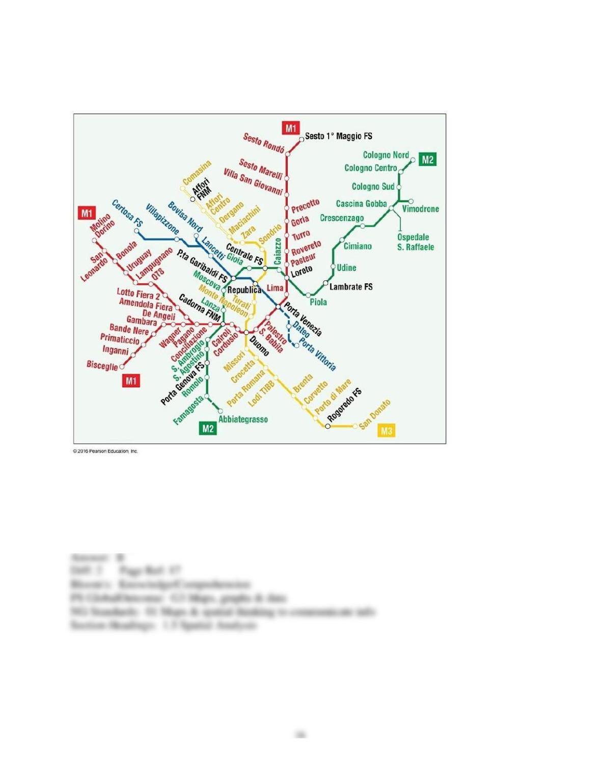
1) The map of the Metro system in Milan, Italy in the figure above is an example of a
A) mental map.
B) topological map.
C) cognitive image.
D) geographic information system.
E) culture region.
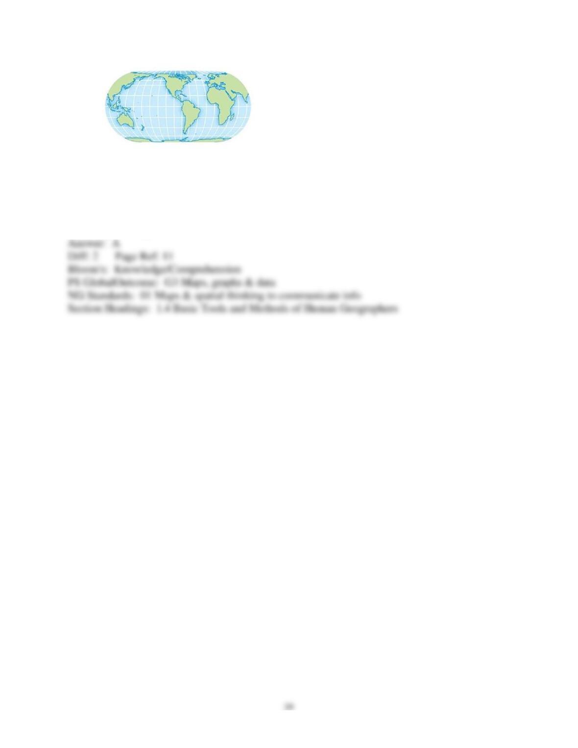
2) The above map is an example of a
A) Robinson Projection map.
B) Azimuthal equidistant projection map.
C) Mercator projection map.
D) cartogram.
E) choropleth map.
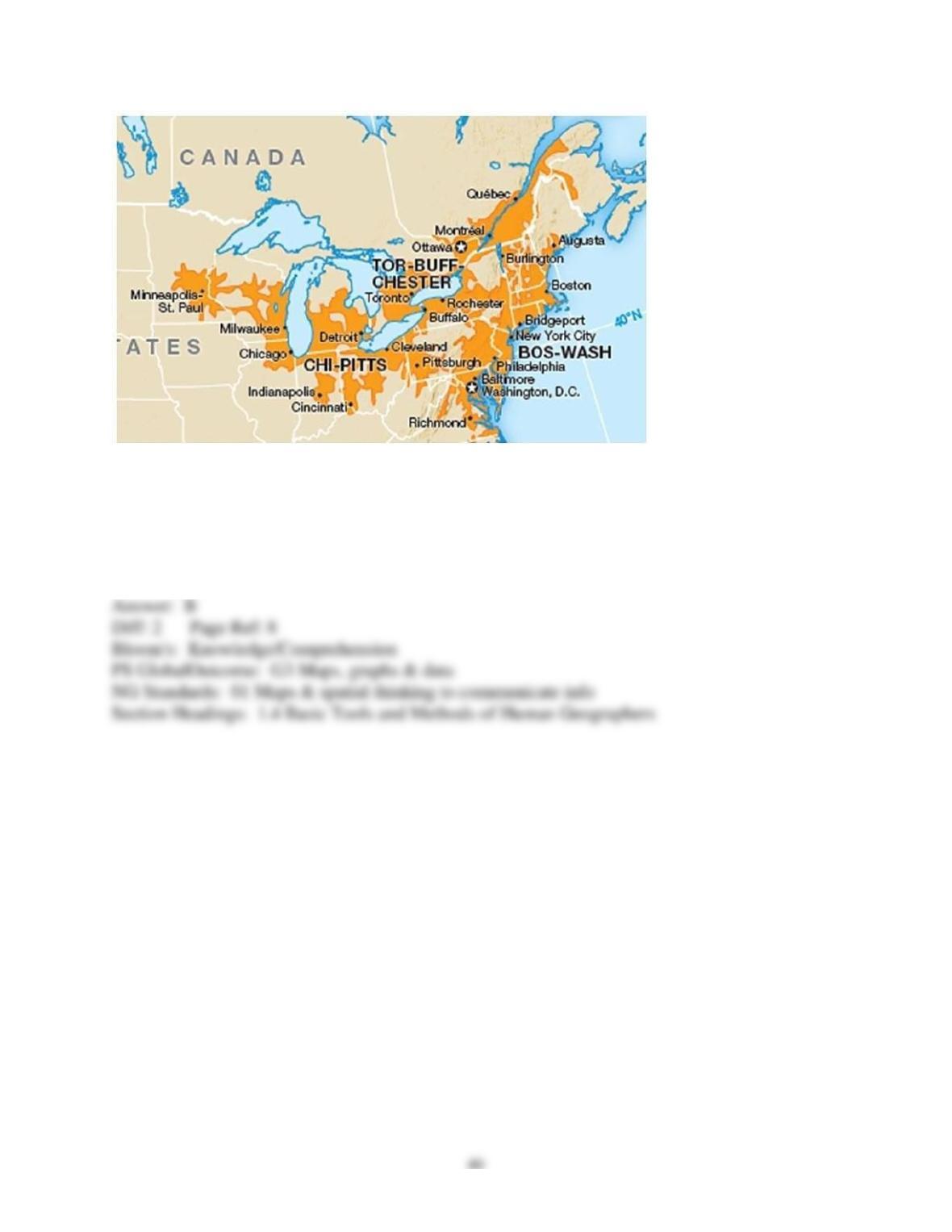
3) The shaded areas in the above map best represent
A) functional regions.
B) mega-regions.
C) spatial diffusion.
D) regionalization.
E) irredentism.
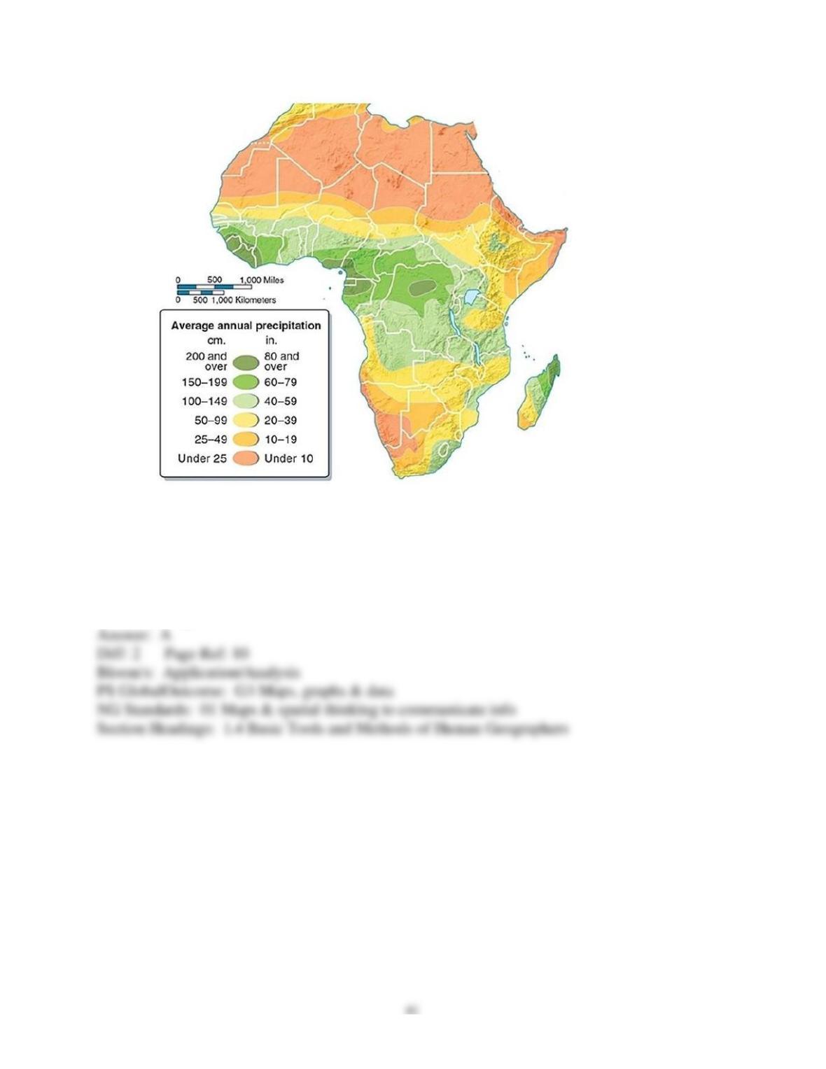
4) The above map is an example of a(n)
A) isopleth map.
B) topographic map.
C) located chart map.
D) azimuthal equidistant projection.
E) mental map.
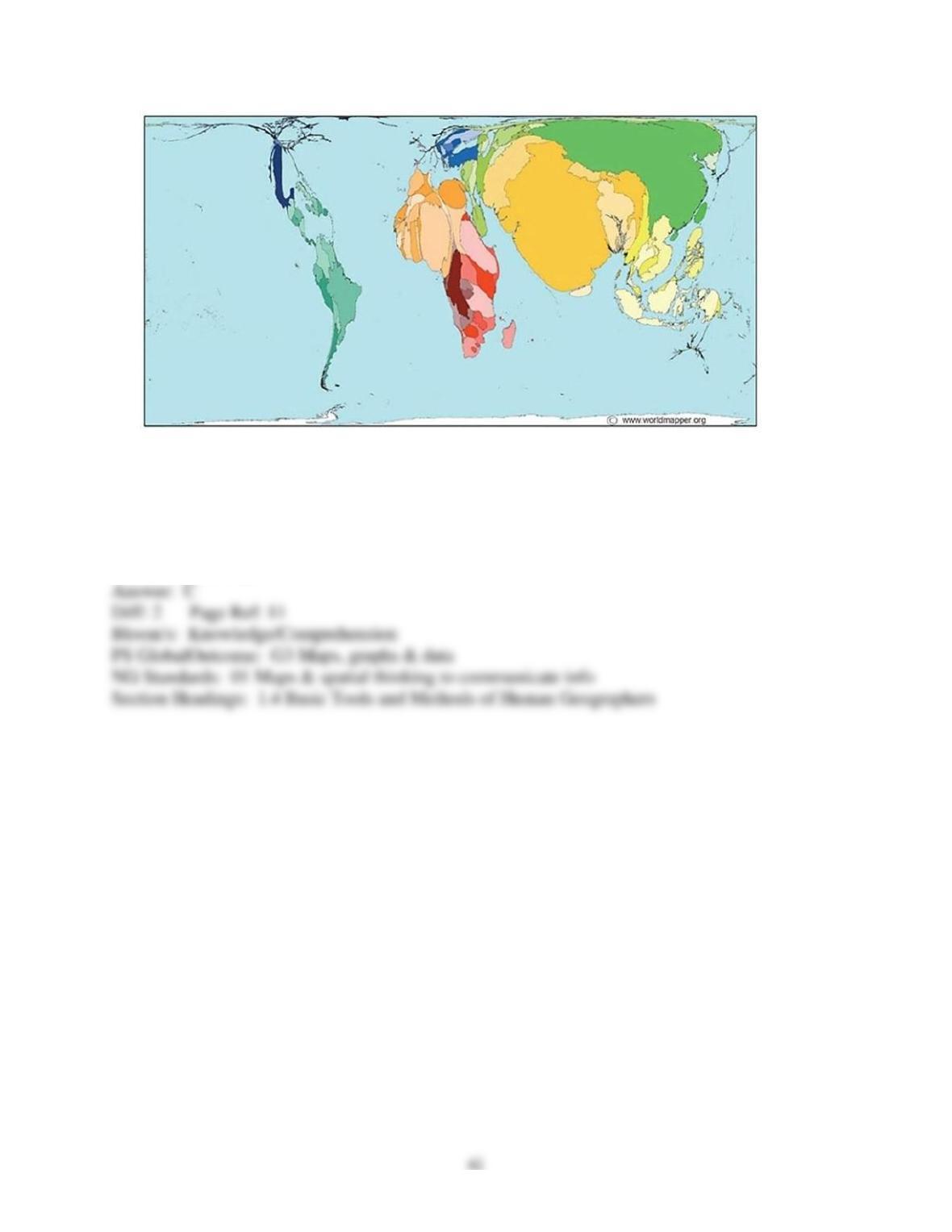
5) The above map is an example of a(n)
A) isopleth map.
B) GIS map.
C) cartogram.
D) Mercator projection map.
E) topological map.
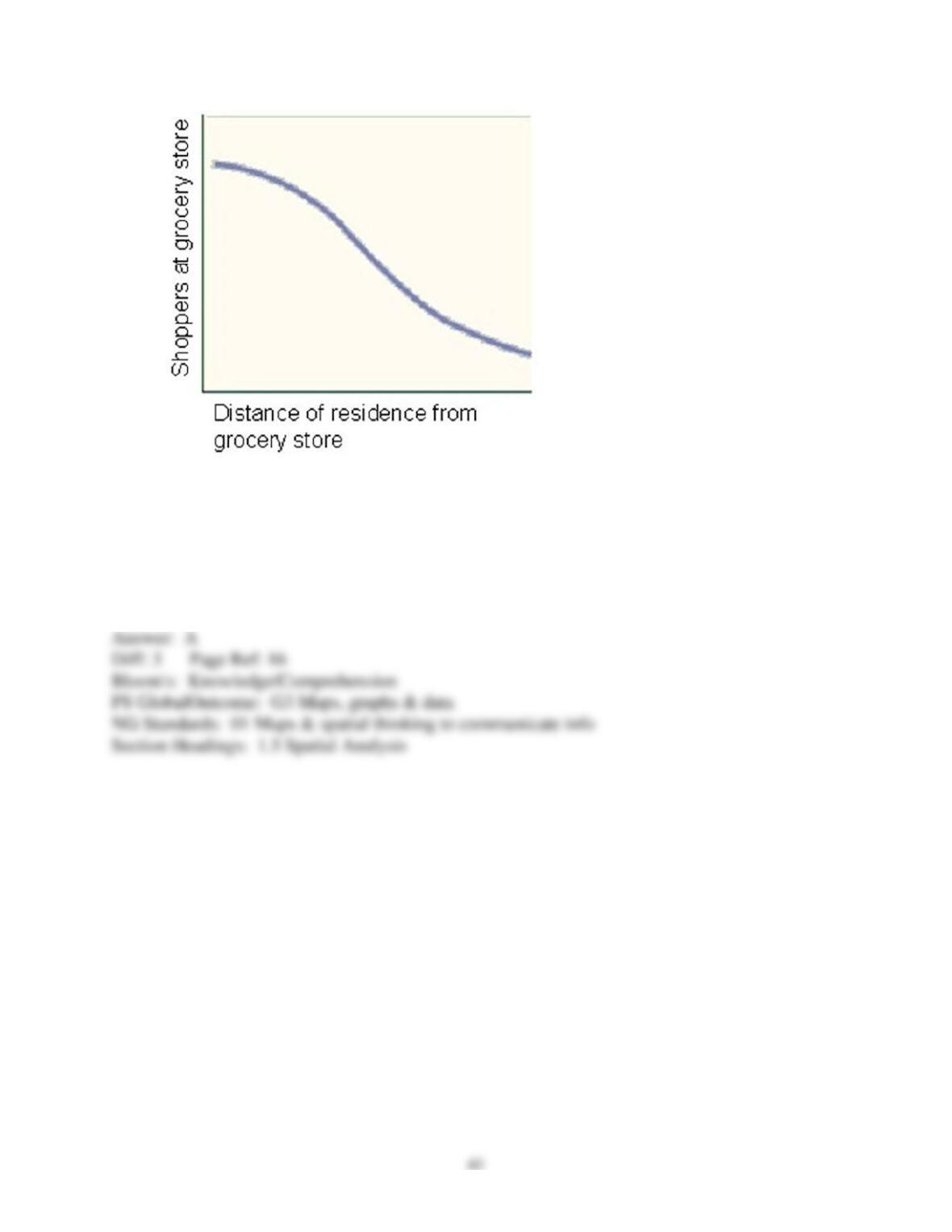
6) The above graph shows that the farther people have to travel, the less likely they are to do so.
The inhibiting effect of distance is ascribed to
A) the friction of distance.
B) the problem of space.
C) time-space convergence.
D) cognitive distance.
E) irredentism.
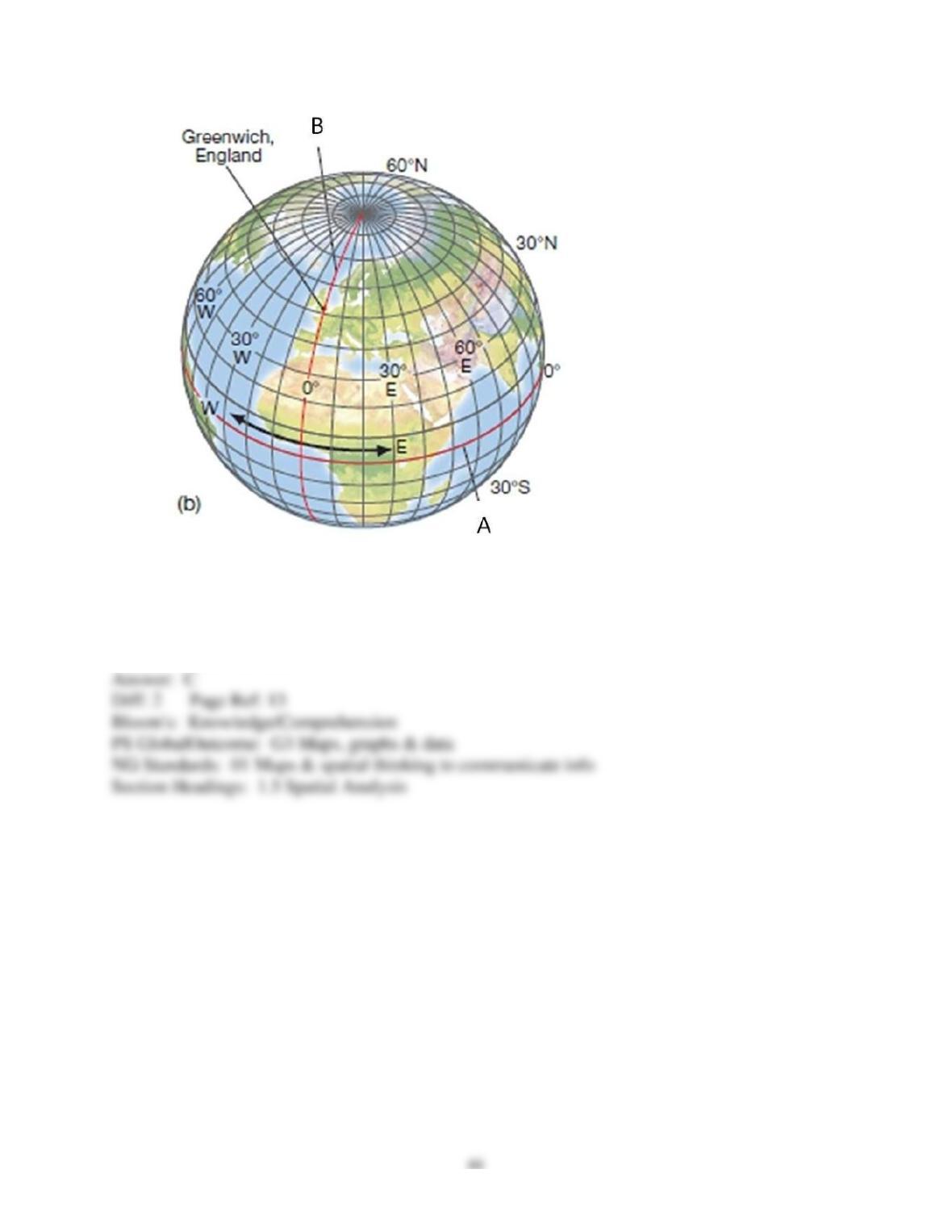
7) Line A in the above map represents
A) the Prime Meridian
B) a line of longitude.
C) the Equator.
D) the international date line.
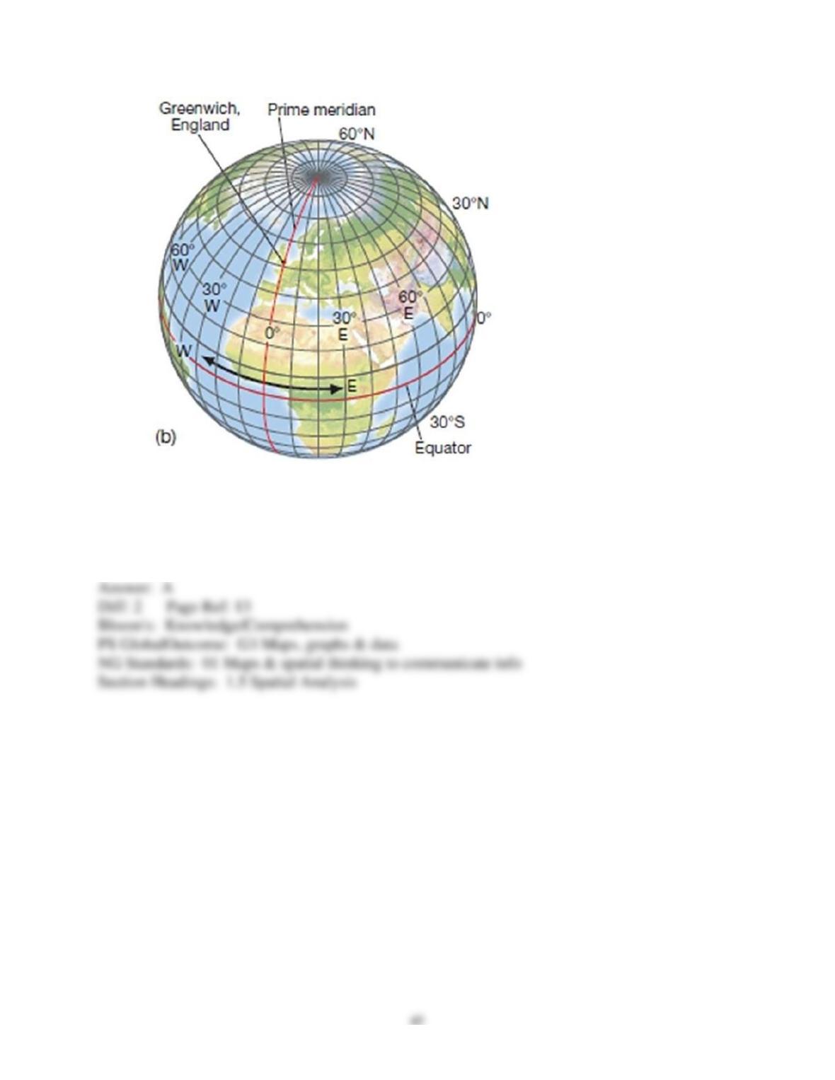
8) Line B in the above map represents
A) the Prime Meridian.
B) a line of latitude.
C) the Equator.
D) the division between North and South.