1
The Financial and Banking System of:
Germany
Presented
In Partial Fulfillments of the
Course Requirements
for
FIN 4634
International (Global) Banking
Prepared for:
Marcos A. Kerbel
Participating Adjunct Professor
Department of Finance
Florida International University
Miami, Florida
Prepared by:
Leonardo Torres
ID:5060227
(786)-369-9534
Ltorr135@fiu.edu
Date of Report
April, 16, 2017

2
I. Table of content PG.2-3
II. Geography PG.5-7
III. History of Germany PG.7-8
IV. Germany Financial System PG.8-14
A. Historical Overview pg. 8
B. Present Monetary and Law Regulations pg. 9-10
C. Types of Financial Institutions operating in the country pg. 10
D. The Central Bank pg. 10
E. Bank Regulation pg. 11-12
F. Commercial Banks operating in Ecuador pg. 12-14
1. Commercial-Principal domestic and foreign banks operating in the country pg. 11
2. Savings & Mortgage Banks pg. 12
3. Development Banks pg. 12-13
4. Other Financial firms pg. 14
V. Germany Balance of Payment and Balance of Trade- Principal Sources of Exports,
Imports, investments, and funds transfers PG. 14-17
VI. Foreign Reserves PG. 17-18
VII. Current Situation of the country’s currency PG. 18-19

3
VIII. Risk of those banks in Germany face- such Currency, Political, Regulatory,
Crime, etc. PG. 19-20
IX. What is Germany doing about Preventing, Detecting and Eradicating Money
Laundering and Terrorist Financing? PG. 20–21
X. Important Bank Failures and Scandals in Germany. PG. 20
XI. Summary and Conclusion PG. 21
XII. What is the Future Outlook for Germany and its Financial System PG.21
XIII. Would you Approve Lines of Credit for Banks in this Germany? PG.21–22
Explain Your Yes or No Decision.
XIV. Appendices PG. 22-24
XV. Bibliography/Footnotes PG.24–25
XVI PG. 26
4
The Financial and Banking System of: Ecuador
II. Geography
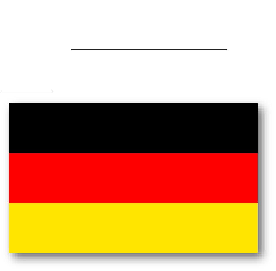
The German flag consists of three equal horizontal stripes – the bottom stripe is gold;
the middle is red; and the stop stripe is black.
These colors have been associated with Germany ever since the middle ages but there
is knowledge of the current German flag colors being traced back to early 19th century
war volunteers, who posed as military forces during the Napoleonic wars. The colors
are mainly based on the colors used for the uniforms of these soldiers which were black
5
coats with red braid and gold buttons. The modern flag was espoused on May 9,1949.
The current colors of the German flag now are a representation of the unification of
Germany as a country.
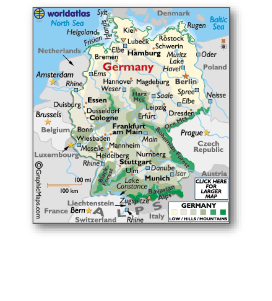
If measured by size, Germany happens to be the seventh-largest European country and
there is quite a variation from north to south in the topography.

6
The North European Plain encompasses across the northern grasps of the country; this
flat, low-lying terrain is dismembered by several bogs, rivers and streams, and is mostly
used as farmland.
The North Sea shoreline is low, swampy wet land, with ditches, mudflats and
disseminated islands. The Baltic Sea is mountainous with some toothed cliffs. Rugen,
Germany’s biggest island, is forested and relatively mountainous with steep cliffs and
sandy beaches.
In the northeast, and then extending to the south of Berlin, Germany’s land remains
sandy and scattered by loads of generally lesser lakes formed by receding glaciers
during the last Ice Age.
The land then upswings into the forested uplands of central Germany. Main landforms
here involve the volcanic in origin Harz Mountains and the densely
wooded Rothaargebirge Mountains.
Further south the smoothed hills and mountains of the Eifel and Huynsruck
uplands front the Rhine River Valley. The Vogelsberg Mountains, Rhon Plateau and
Thuringian Forest are the dominate features that move eastward through Germany. The
uplands linger eastward, ultimately rising into the Ore Mountains on the Czech Republic
margin.
In the distant south the land remains mostly mountainous, with greatly forested
mountains.
1
Location:
Central Europe, bordering the Baltic Sea and the North Sea, between the Netherlands
and Poland, south of Denmark
1
“Europe.” World Atlas – Maps, Geography, travel. N.p., 12 Aug. 2015. Web. 16 Apr. 2017.
Geographic
coordinates:
51 00 N, 9 00 E
Land
boundaries:
total: 3,621 km
border countries: Austria 784 km, Belgium 167 km, Czech Republic 646 km, Denmark
68 km, France 451 km, Luxembourg 138 km, Netherlands 577 km, Poland 456 km,
Switzerland 334 km
Terrain:
lowlands in north, uplands in center, Bavarian Alps in south
Natural hazards:
flooding
Environment –
emissions from coal-burning utilities and industries contribute to air pollution; acid rain,
resulting from sulfur dioxide emissions, is damaging forests; pollution in the Baltic Sea
from raw sewage and industrial effluents from rivers in eastern Germany; hazardous
waste disposal; government established a mechanism for ending the use of nuclear
power over the next 15 years; government working to meet EU commitment to identify
current issues: