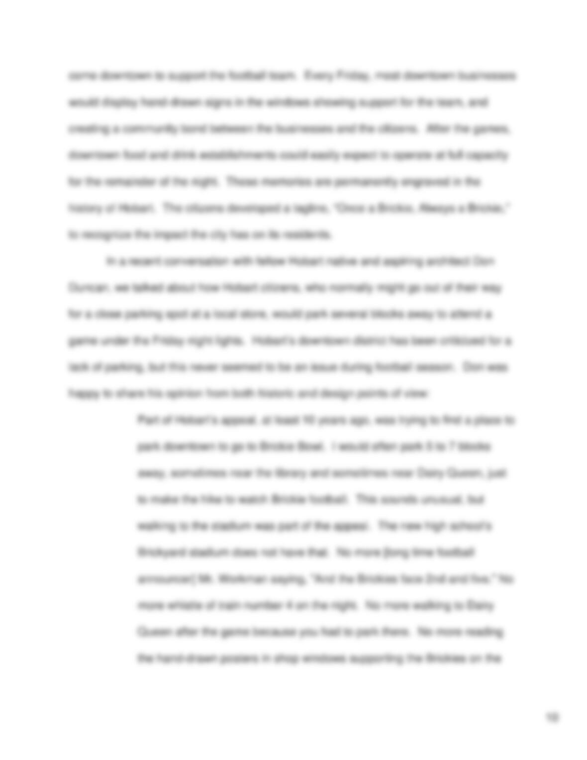
Mixed–Use Architecture and Local Economic Factors
Contributing to the Success of Urban Areas and Downtown Districts;
A Comprehensive Analysis of Hobart, Indiana
An Honors Thesis (HONRS 490)
by
Anthony Gary
Thesis Advisor
Geri Strecker
Ball State University
Muncie, IN
March, 2012
Expected Date of Graduation
May, 2012

Abstract
The future of cities has been improved by recent successes in mixed-use building types
and walkable urban spaces. As the world becomes more conscious in regards to
sustainability and carbon emissions, cities must adapt to remain economically
competitive. This project uses my hometown, Hobart, Indiana, as a case study. Hobart
has a rich history in community pride and support for local athletics, which contributed to
the downtown district’s success for decades. In recent years, failing small businesses
and decreasing community engagement have caused downtown Hobart’s appeal to
decline. Local government recognizes the decline and has been working to improve the
downtown district. I evaluate some of the recent improvement techniques, and I make
suggestions of my own to encourage the future downtown success. I also offer
architectural improvement examples to create more versatile, mixed-use buildings.
Acknowledgements
I want to thank Dr. Geri Strecker, not only for advising this project, but for being an
incredible resource and my “go-to” faculty member since my very first day of college.
She has always believed in me and pushed me to produce the best work possible. I
cannot show my appreciation enough!
I would also like to thank Linda Buzinec for her historical insight and Rosalie Pfister for
providing incredible digital copies of photos—some captured over 100 years ago!
2
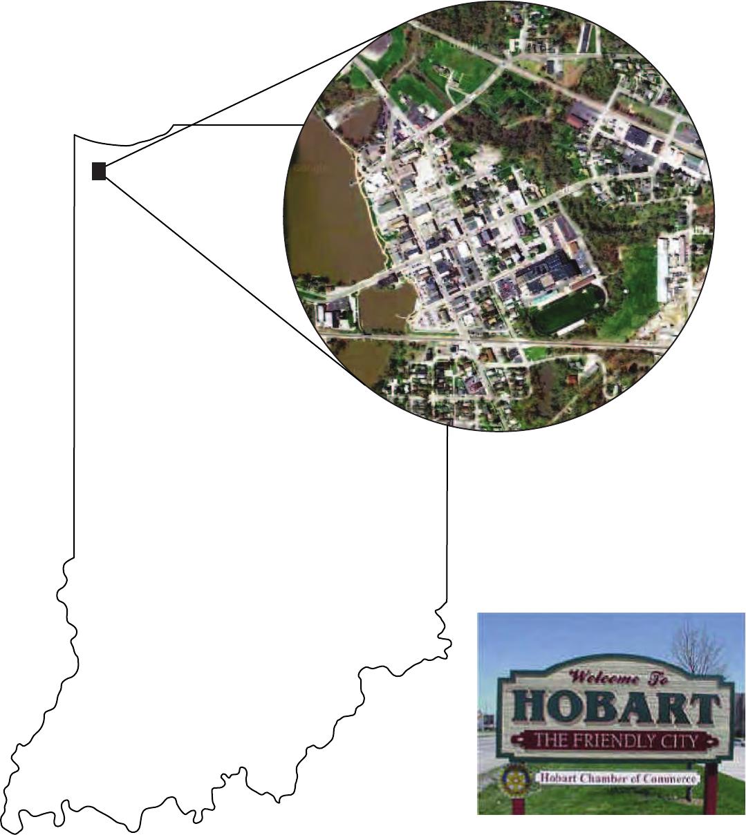
Hobart, Indiana Established 1847
“The Friendly City”
3
Source: northwestindiana.com
During my first semester at Ball State University, I authored a comprehensive
paper on the contributing factors and effects of urban sprawl. Sprawling cities rely
heavily on the automobile for transportation and place little emphasis on human
walkability. Since that time, my education in architecture and the built environment has
persuaded my thinking. Rather than ranting about the negative effects of a sprawled
community, this project will focus on the importance of city and downtown development.
The British organization Future Agenda suggests by 2020 more than half the world’s
population will be living in cities. It will become increasingly necessary to accommodate
growing populations with communities that engage residents to evolve with “green”
movements and sustainable life practices. At the same time, these communities must
meet the needs and interests of their residents.
Many downtown districts are currently modeled after the “20 minute community,”
popularized by small districts in west coast cities such as Seattle, Washington, and
Portland, Oregon. These districts are successful because citizens live within walking
distance of their workplaces and amenities, leading to efficient, healthy lifestyles.
Expanding cities must be more focused on the pedestrian and less focused on the car.
I approached my current studio professor and urban designer Bruce Race with this
notion, and he agreed. Race believes “a walking city where we can access our
everyday needs without driving will be a critical indicator of [future] success.” This
means urban, mixed-use architecture should be interactive with the pedestrian and
provide proximate housing solutions. The architecture must also be versatile to
accommodate a future where investors will compete with growing global markets. My
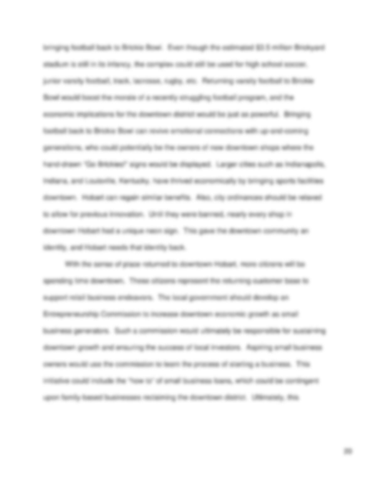
hometown—Hobart, Indiana—could benefit from these principles.
4
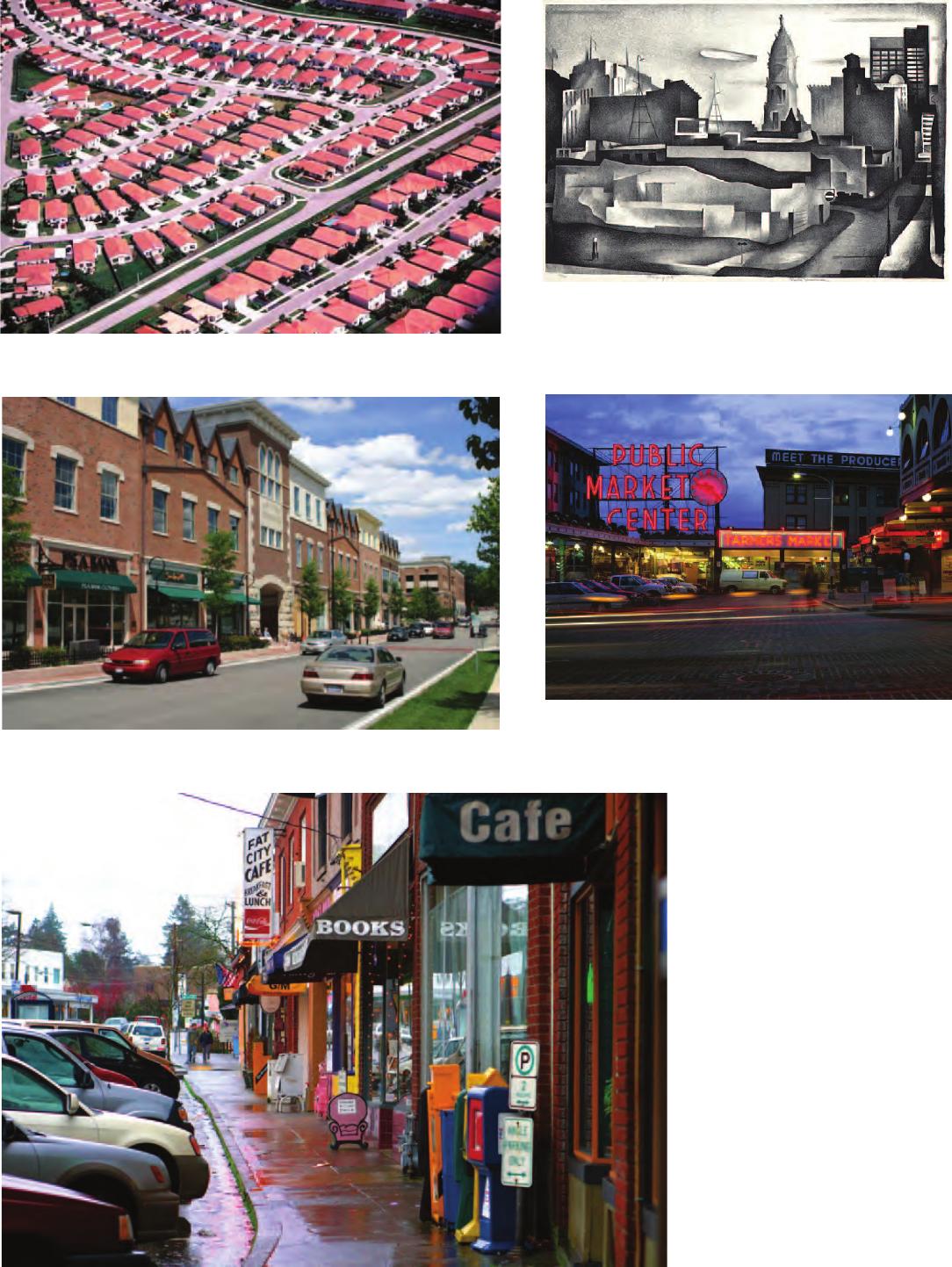
A sprawling neighborhood, Anytown, USA.
Source: taxpawer.com
Changing City – 1934
Painting by Doland Maxwell
Source: http://www.dolanmaxwell.com/
Urban renewal example – A walkable market
center in Seattle, Washington.
Source: travel.nationalgeographic.com
Walkable downtown development – Naperville, Illinois.
Source: dkjhomes.com
20 minute community example
Multnomah Village
Portland, Oregon
Source: portlandground.com
5
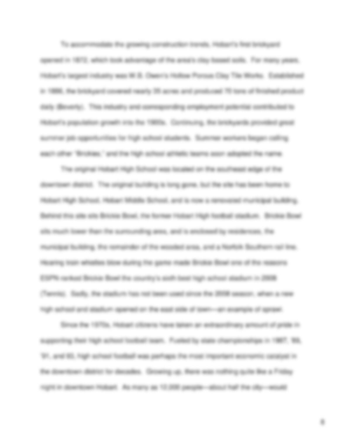
The history of Hobart, Indiana, begins in 1847 when Englishman architect/builder
George Earle (1807-1876) laid plots for a new town on heavily forested land purchased
from the Pottawatomi Indians. The name “Hobart” was chosen in memory of his
brother, Frederick Hobart Earle (Beverly). Earle commissioned a dam on the southeast
end of Deep River, which lead to the creation of Lake George. Earle constructed a grist
mill on the lakefront soon after, which remained a stable business for many years.
Earle took advantage of Lake George as an asset and developed the downtown district
adjacent to the east. The city is now part of Lake County.
The downtown street grid is anchored by Main Street, the major north-south
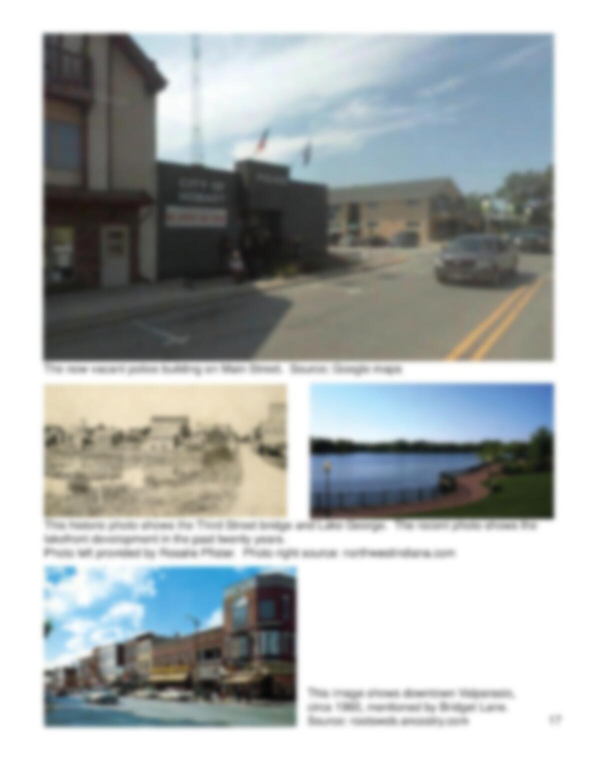
artery running parallel to Lake George. Third Street, the major east-west axis, crosses
Lake George and connects downtown with nearby neighborhoods. The “Corner of Third
and Main” is known as the epicenter of the downtown district. In the decades after
Earle laid the city plots, construction began on a downtown streetscape. The district
had a constant theme of 1 to 3-story buildings, which created a street wall to enclose
and define it as an urban corridor. The bulk of the buildings were designed as
commercial mixed-use (CMU) developments. CMU buildings typically feature retail
storefronts facing the street with residential units occupying the levels above.
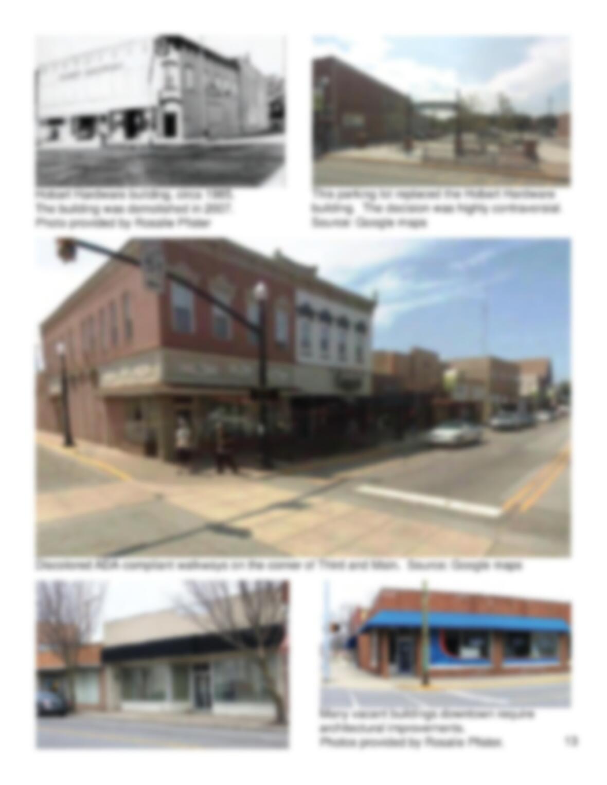
Entrepreneurs waited little time before investing in downtown Hobart’s economic
growth potential. According to Hobart, Indiana: The Friendly City (1978), published by
the Hobart Historical Society, “Hobart was a thriving community with a large grist mill,
four dry good stores, a hardware store, a drugstore, a furniture store, two blacksmith
shops, …a cooper’s shop, and a bakery all by 1870” (ctd. in Pfister).
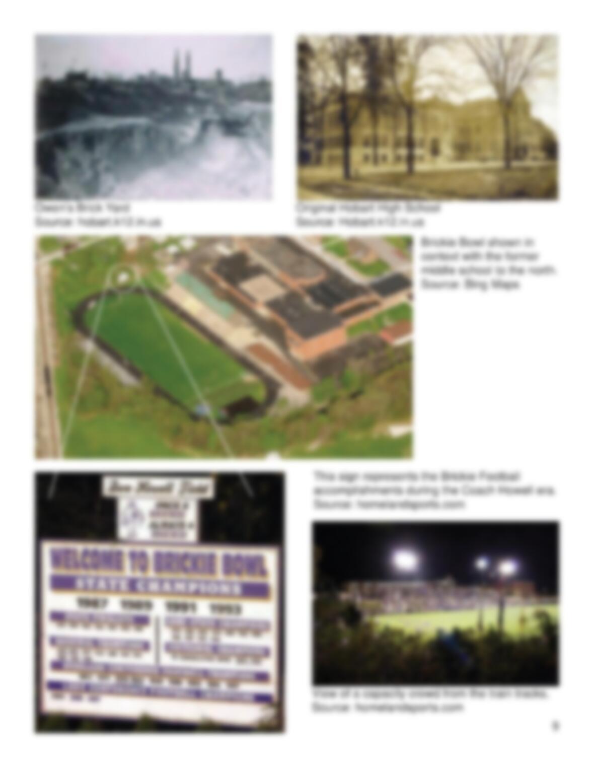
6
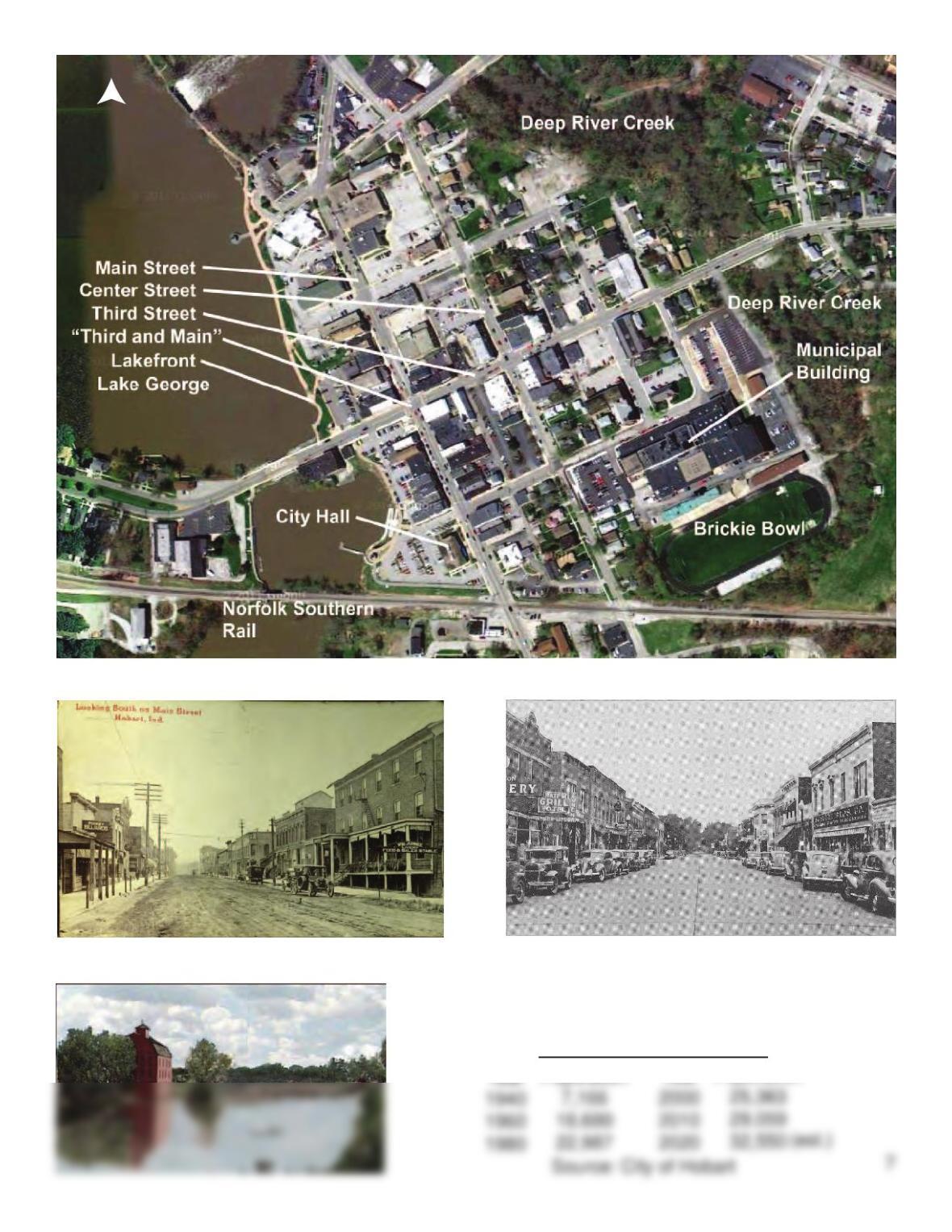
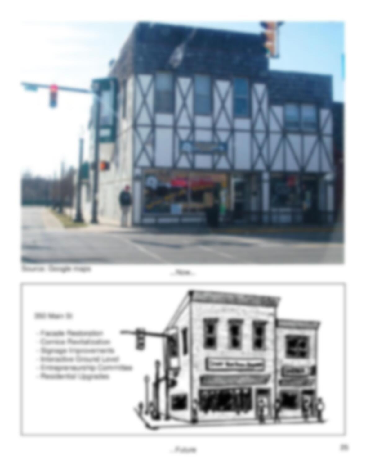
Downtown Hobart, Indiana 2012 – Source: Google Maps
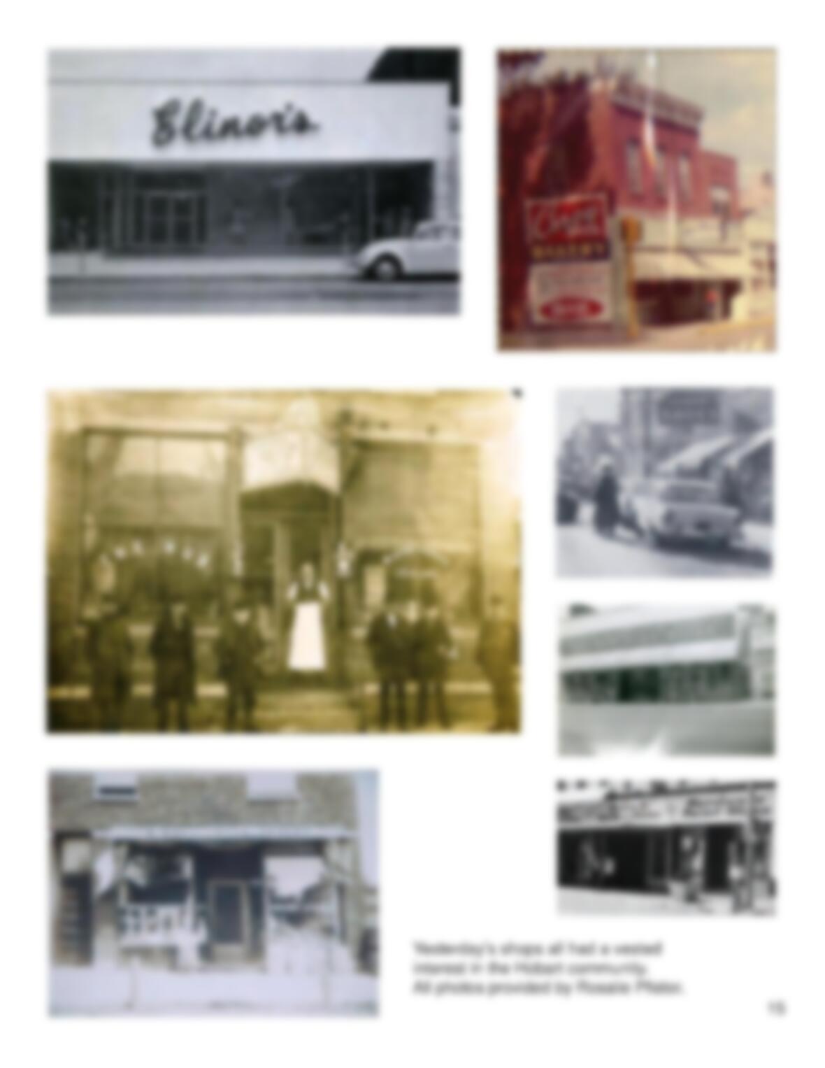
Main Street looking south, circa 1895
Photo provided by Rosalie Pfister Main Street looking north, Circa 1940
Photo provided by Rosalie Pfister
Earle’s grist mill.
Source: frankandjackie.com
Hobart’s Population Trend
Population
Year
Population
North